Torres del Paine
Posted on February 12, 2019 - Leave a Comment
Trekking in Patagonia
Cliff Lancey
March 14, 2014
The plane lands. It is winter in Atlanta. But that was 18 hours ago. Overnight we have flown clear of winter, over spring and even much of the summer. There is the feel of Autumn here in Patagonia.
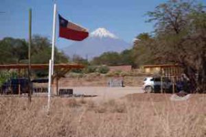
We are in the town of Punta Arenas, Chile. It is about as far south as a man can go and still call a cab. With the exception of Ushuaia, a cow town a hundred miles or so away, Punta is the most southerly city on the planet. Like all far-flung places, it not only looks different, it feels different. People are still driving cars, buying groceries, walking dogs. But there is a different vibe. They love dogs. They are like sacred cows. There is no leash law. Dogs roam the city streets, snoozing in the doorways, lounging on sidewalks, sniffing passersby. On every corner there is some old mutt fast asleep on a busy sidewalk. The architecture is potpourri, almost motley. Here a hulking Spanish Colonial palazzo, now converted to a school, next to a curious, gabled pile, the home, a century ago, of one of those misfit seafarers who ran out of time and ocean. 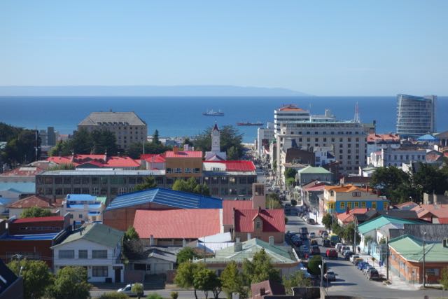
Jim and I grab a cab at the airport. We negotiate a price in what passes for our spanish, and head toward downtown. Ken wasn’t in baggage claim even though he departed Santiago well ahead of us. There is no cell service. If he made it, he’s in baggage or in the hotel bar.
Just outside the airport the ocean appears. The ocean is everywhere at the southern tip of South America. But this is not merely the ocean, it is the Strait of Magellan. Here for several hundred years – until the Panama Canal – was the safe route to the Pacific, preferred to the wilds of Cape Horn. Magellan discovered it during the first circumnavigation of the world in 1520. Across the Strait in the distance is a dark headland, Tierra del Fuego. The Land of Flames.
Punta was built after an earlier settlement farther south collapsed. We visited the original settlement at Fuerte Bulnes. It looks like an old Western fort of rough logs behind a stockade. Only a few miles farther south is Cape Froward, the southerly tip of the South American continent. Cape Horn lies beyond, in an archipelago which runs up the Chilean coast.
They are making a movie in Bulnes. In a side yard of the fort a handful of actors in pioneer clothes are lounging around, munching sandwiches. A log hut and the ground nearby are covered in a blanket of Hollywood snow. A technician wrestles with a machine which is intermittently spitting out white wisps of something. It isn’t going well. 
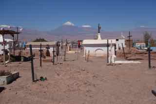
Its a Chilean TV drama about Puerto del Hambre, another historic site just up the road. Here the Spanish built a military post in 1584. When an English ship arrived in 1587, everybody was dead – starved or frozen. The name means Port Famine. We stopped to visit. There’s not much. If we were expecting a Port Famine Kentucky Fried Chicken, we were disappointed. A weather-worn plaque describes some ruins. A steep hill drops to a rocky tidal flat. On a barren knoll is a small cemetery. It is a bleak place.
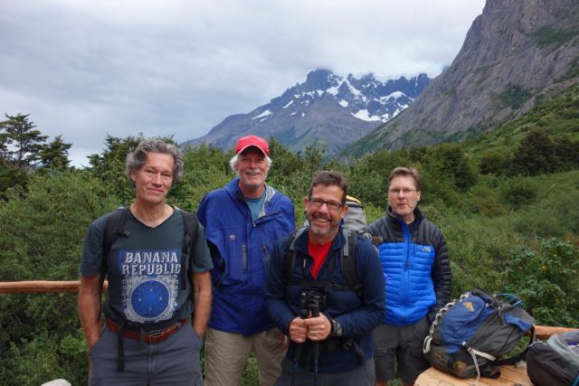
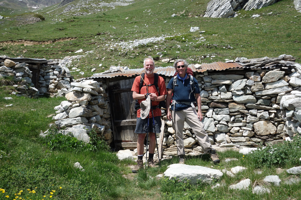
Tomorrow we leave Punta Arenas on a 9-day trek in Torres del Paine. It’s pronounced PI-knee. Ken, Jim, Randall and I are old friends. We have been hiking together since the 70s.
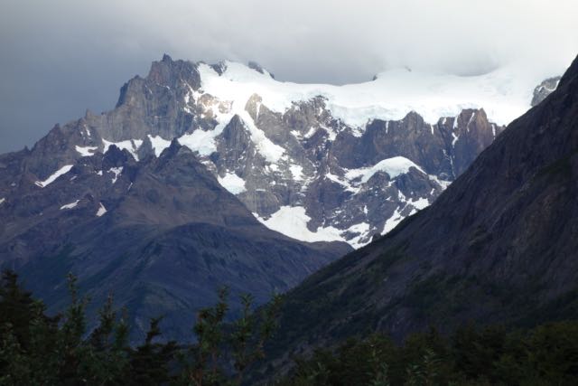
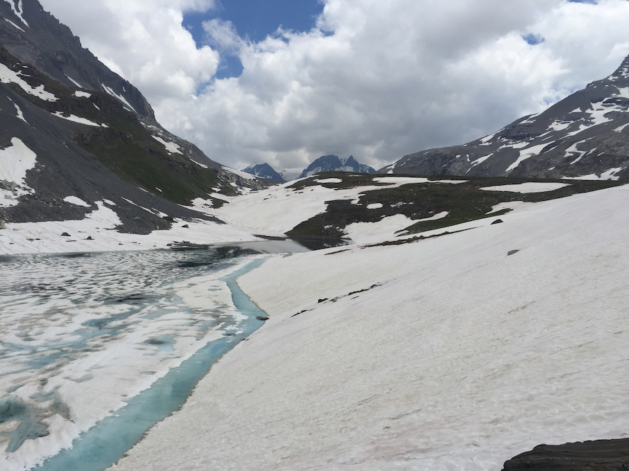
Torres del Paine is a national park. It is a “cordillera” or range of the Southern Andes. The profusion of glaciers has sculpted the mountains into jagged granite peaks and ridges. There are 48 glaciers in Torres. Some are small “hanging” glaciers, not much more than snowfields caught in the teeth of the ridge. Others, like Glaciar Grey are breathtaking.
At Paso John Gardner we got our first glimpse of Glaciar Grey. It is the vista of another world. From Lago Grey it stretches back into the Andes as far as one can see – a river of ice miles wide. It is a frontier. The hide of a glacier is ridged and rough. By definition it is moving, and as it moves, the ice crumples and fractures, leaving crevasses hidden under the snow. It is a dangerous, no-man’s land. 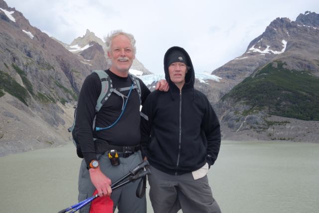
The toe of the glacier rises a hundred feet or more above the lake. A boat from a nearby refugio takes visitors for a closer look, but not too close. The ice breaks off in calves, as they call them, which plunge into the lake. At the other end of the lake, the wind has blown a cove full of icebergs.
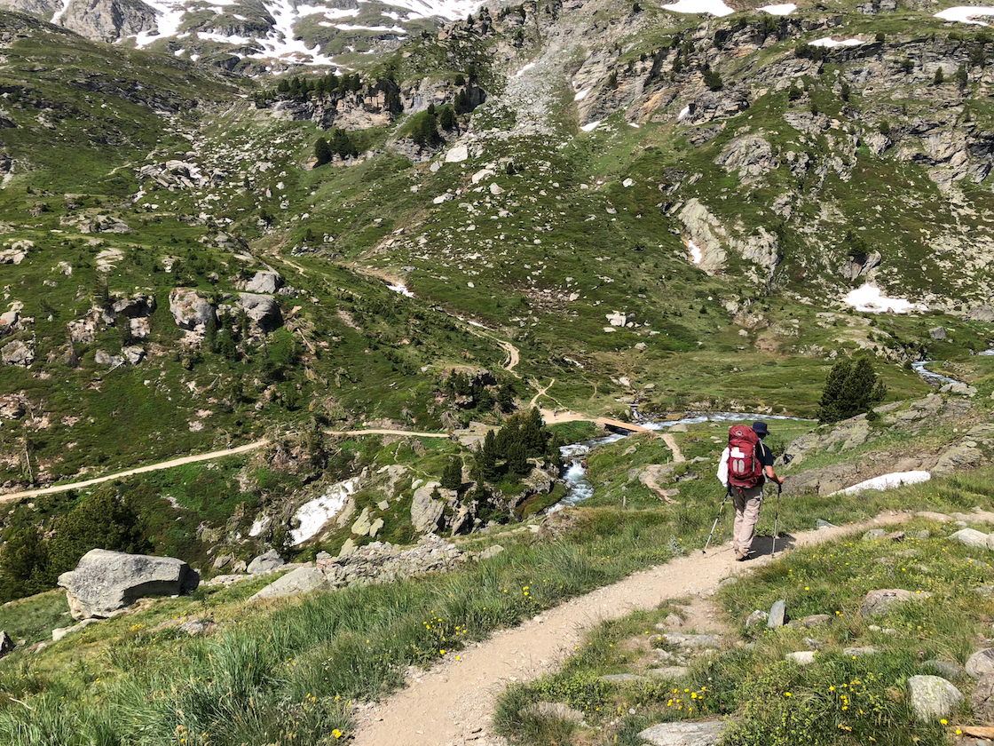
The first day was 20 miles to Lago Dickson – a very long walk. Half the day it rained. We climbed over ridges, through bogs, across streams and meadows. Lunch was in a cramped hut at Puesto Seron, eight miles in. We were almost shoulder to shoulder, but happy enough to be out of the rain. It was raining hard when we left, but above Seron it stopped. We climbed up and down a rocky ridge. Lago Paine glittered in the sun below us. We arrived at the campsite, Refugio Dickson, at 7. We had started at 8:30.
It was a pleasant camp. Pleasant doesn’t actually express it. Wherever we can drop the packs and stop hiking is hallowed ground. The tents lie in the trees at the edge of a field. In the center is the Refugio, a small building with bunks and a shower room. A few feet away a smaller hut, almost a kiosk, sells beer and Gato, a box red wine. Jim, a wine guy, waves off the Gato. I could have bathed in it, drank it till I hallucinated.
Everything is sore. But that’s why they make ibuprofen, hot showers and Gato. There was wine in the dinner tent. God bless the porters. We stepped outside into the dark. Somebody pointed to the Southern Cross.
There are twelve in this trek group. Mom, dad and two college sons from San Francisco, a vet from Santa Cruz, a free spirit from Boulder, a doc from Florida, a woman doc from Germany, and us. There are several porters, whom we see in the evening, and three guides, Daniell, Christiane and Oche. 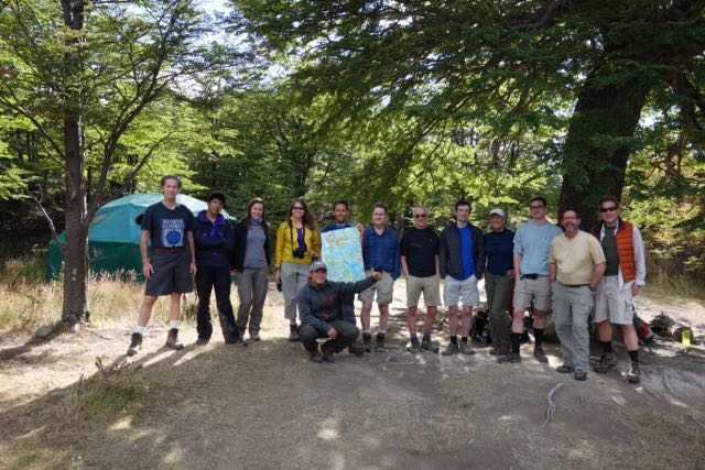
The second day was 8 miles. A nice break. We are following the “Circuit”, an almost 80-mile circle around the mountain range. We started on the east side, near the park entrance, and headed north and west along Rio Paine. Today we continue southwest, along Rio de los Perros to the campamento.
We enter a forest threaded by streams. There are homemade bridges of logs nailed together. These bridges – and there are a hundred of them – are a sketchy business. They are built with whatever comes to hand, logs, planks, rope, chicken wire. There is water everywhere. Here in late summer the glaciers melt, which makes for torrential streams and bogs. It is up and down. We scale several canyons with homemade ladders of pipe and wire. They are pretty solid, but they don’t look so good. They are meant to be fastened with bolts to the rock, but the brackets are all empty. They are lashed together instead by cables and rope tied to abutments at the top. The first steps down the ladder are slow going. It is a long fall, and would certainly hold up dinner. Oche scampers down the ladders like a monkey, facing out stair-wise, holding everyone’s walking sticks in one hand. 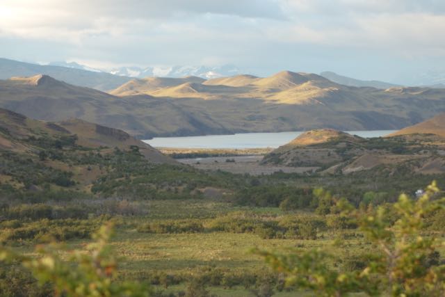
Through the woods, the twelve of us creep along single file. We are something like bugs dwarfed by the landscape. We climb hand over hand up rocky passages, cross foaming streams, while overhead torrents of water spill from the melt.
There are three women in the group. One belongs to the Bay Area family. The other two are solo. One is from Boulder, Colorado, a sort of graying hippie. This is probably her thing, living freestyle, between poverty and the delights of the wilderness. The German neurologist is nice enough but not exactly friendly. Germans are just different. Good people, for sure, but not interested in getting to know you.
Also, it takes a special resolve to make this kind of trip if you’re female. Unlike back home, it is still something of a man’s world in the sub-Antarctic wilderness. After dinner men gather together, drink wine, get loud and talkative. The women retire early. They are not shy. Perhaps it is just not their world. I think of my wife. An exception to the guarded-ness of women. She would be up all night, drinking and laughing, oblivious that all the women had retired – and then be up at 6 in the morning ready to go. No shyness I have ever detected. But she’s not a trekker. Its a shame.
 The Los Perros camp is in a grove of trees. A hundred yards away the river lies behind a field of high grass. Not far beyond rises a granite wall. To one side, behind a slope, is Glaciar Perros. We saw it on the approach. It rises overhead, a crest of ice in ethereal tints of blue. As the late sun lit up the wall, we climbed a steep moraine to see the glacier up close. We had to settle for the lago. It lay in a bowl, like soup, thick with the fill carried from the glacier.
In the middle of the camp the porters have tied a slackline. It’s a long nylon strap winched between two trees. They walk it like a tightrope. It is a test of strength and balance – the skills that make good porters. These guys walk phenomenal distances up and down the mountains carrying all the stuff that, well, we older guys are willing to pay someone else to carry. 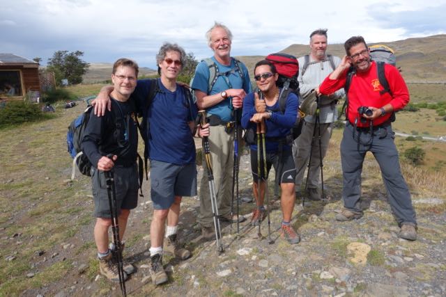 Christiane, one of our guys, is bouncing side-saddle. He tosses himself in the air and lands standing on the strap. He teeters there for a moment, dances a few feet, loses his balance and hops off. Nearby a Chilean girl watches the young men. She helps the cook. You can see why these boys risk breaking their ankles on the slackline. Chilean women are slender, shapely, dark-skinned beauties. Or maybe its the Chilean blue jeans. We debate this among ourselves at some length.
A short boyish-looking fellow in official green with epaulets asks us to sign a book. It is the only evidence of civil authority. This is a premier national park, yet to all appearances the enterprise is run by the young men who work for the trek companies. Though there is no sign of the authorities, neither is there sign of any need. All of the Chilean guys – every one of them – are smiling and friendly. Each has a role in keeping the trekkers fed and on task. Most of them come from Puerto Natales and other nearby towns, where good jobs are scarce. By dint of strength and endurance they hold jobs as porters, happy, it appears, to make good money taking long walks in the mountains. They’re mostly contract guys, signing up with this group or that. Carrying a third of your body weight for 20 miles is not easy. But these guys have legs like soccer players. Some of them even carry big rocks on the trail, in their hands, just to show off. In the winter they migrate to the ski resorts. 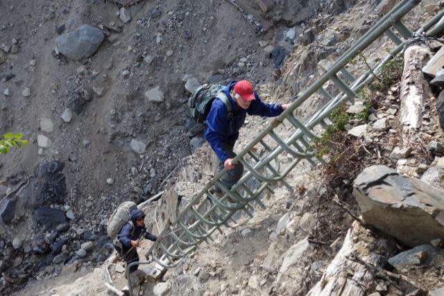
Torres del Paine has few rangers and little overt bureaucracy. But there are rules. They don’t like smoking. Alongside the trail, in the absolute middle of nowhere, Ken asked Daniell if he might smoke. Daniell, without his usual tact, flat out told him no. The one thing they fear, apparently, is fire. Although there are streams at every turn, it is not runoff but melt. The climate is actually dry. Daniell does not want the distinction of leading the group that burned the forest down.
The morning of the Paso we wake at 5:00. It is still dark when we head into the woods. Daniell has simple instructions. Wear everything – raincoat, rainpants, sweaters, hat and gloves. Expect the worst.
The swaying beams of headlamps guide us through a muddy bog. Everybody has a lamp – and ski poles. Everyone except Andy. He is in shorts and leggings.
He is an emergency room doc from Florida. In his early 50s, he has hair to his shoulders. In a floppy canvas hat and shades he looks like Carole King. He describes himself as one of those rootless Jews who were raised nowhere and everywhere. If he is to be believed, his mom divorced when he was young, married a guy who lived in India, where he spent a few early years. He went to live with his sister on a kibbutz. Later they migrated to Spain. In some places he didn’t even go to school. But he got in to Brown – no easy task – and later med school. He studied geology and spent time mapping in Alaska. His father couldn’t pay the tuition, so he went to Bolivia, where he discovered that with the right spiel the customs agents would let him import alpaca sweaters to sell to his Ivy League classmates. You can tell he’s smart, even if he is making all this up. He’s a loner. Booked a space at the last moment. Brought virtually nothing, and in fact borrowed a raincoat from Randall. Just wanted to take a walk, as he explains the decision to join the trek. Andy doesn’t even have poles. On the sometimes hand-over-hand scramble up the steep trails, he is like a goat. Not so the rest of us. It is brutal on the knees. Without our nifty spring-loaded, telescoping walking sticks, it would be almost impossible. I thought the guy was fascinating to talk to. Gave me his theory of pharmacology – which was basically don’t take anything. Imagine, a doctor who says we take too many pills. My psychiatrist pals don’t have a good thing to say about him. They think he’s a phony. They could be right for all I know, my ignorance, gullibility and naivete can be pretty impressive. But it is also obvious that Andy represents something that disturbs them. He’s a bright, accomplished guy, who lives pretty much as he wants. His life may be an act, but he writes the script. Talking to Andy gives you the vague feeling of looking through the bars of your own prison.
As dawn breaks, we are out of the woods and onto a flank of mountain. Streams of melt spill everywhere. It is hard to get used to the availability of water. No filters, no boiling, no iodine. The water is good, “dulce” as Oche says. Sweet.
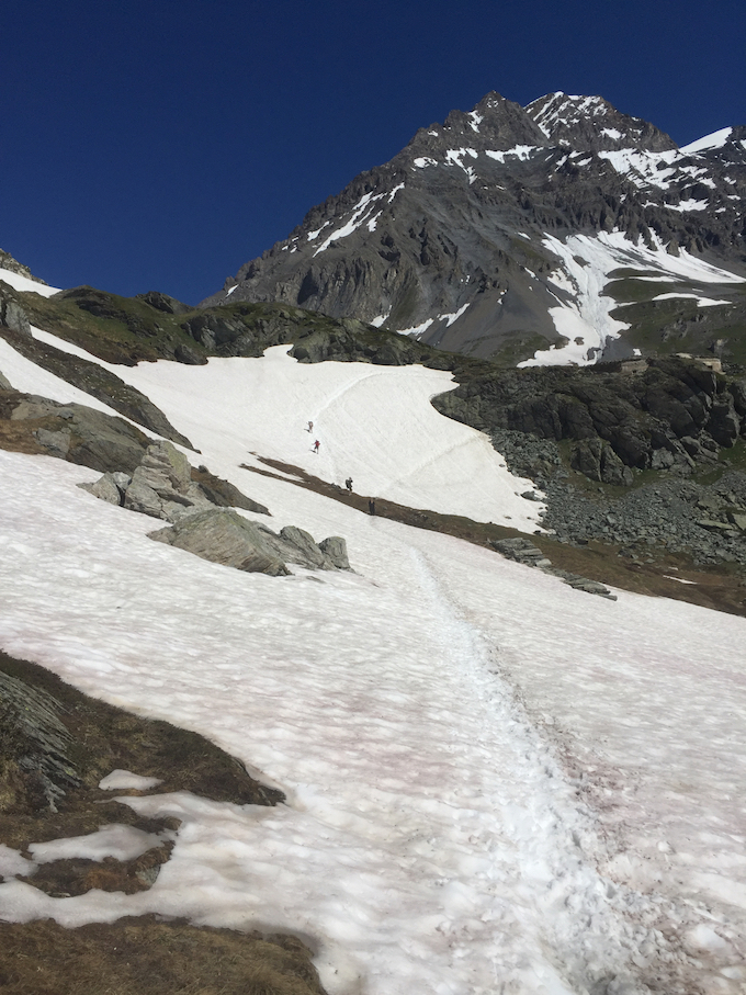
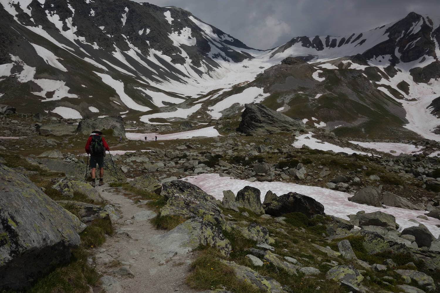
We climb all morning toward Paso John Gardner, the highest and hardest part of the trek. It is so difficult the park won’t let you do it solo, though who would actually stop you is a good question. We are lucky. The weather is good. The wind is sharp, but the sun is out. Below the pass we refill water at a tiny stream. Off come the clothes and on with a dry tee-shirt. On with another shirt, then coat, hat, hood and gloves. With everything zippered up and buttoned down, we head up to the Paso.
The wind picks up, slowly at first. But as we approach the pass it becomes incredible, with gusts like hammer blows. The din drowns out the yells and whoops. At the summit it is hard to hold your balance. We are at the top of the bottom of the world. Fatigue vanishes. We stop for pictures. It’s something like victory. At the far edge of the pass, Glaciar Grey comes into view. The frozen river runs from the intangible distance into the valley below our feet. It has no beginning but seems to flow from the top of the Andes themselves. In this wonderland there is only snow and rock and blue sky. Nothing else, except the few of us, trying to find balance in the wind. We are bits of colored paper on an immense white canvas. 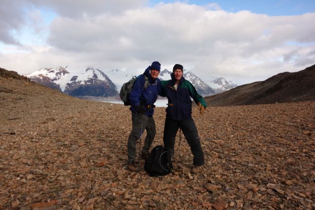
Then it is down, down and down. A couple of hours of down, over rocks and roots, clutching monkey lines, knees in protest, to Refugio Grey. There is a lodge. It has been 22 kilometers. Whatever that is, maybe 14 miles. Converting the metric system is the reason more Americans don’t live here. 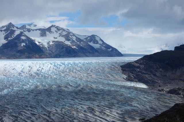
A kilometer is .62 to the mile. That’s hard enough. Then there’s the Chilean peso, at 550 to the buck, or 1.8 or technically .0018 the other way. They’ve got to be getting fat on the fractions. Tourists blowing the math is probably a line item in the Chilean current account surplus. Floats the merchant marine. Finally, there’s the temperature. Celsius. Multiply an afternoon’s 17 degrees by 9 over 5 plus 32. Seriously. By the time you work that out in your head, the temperature has changed.
Its around 6:00. We started at 7 this morning. We kick back in the tents, a little dazed. But a hot shower and a handful of ibuprofen snaps us back. We revive for dinner in the lodge, drink some Chilean wine, loiter on the front deck, but we’re off pretty quickly to sleep.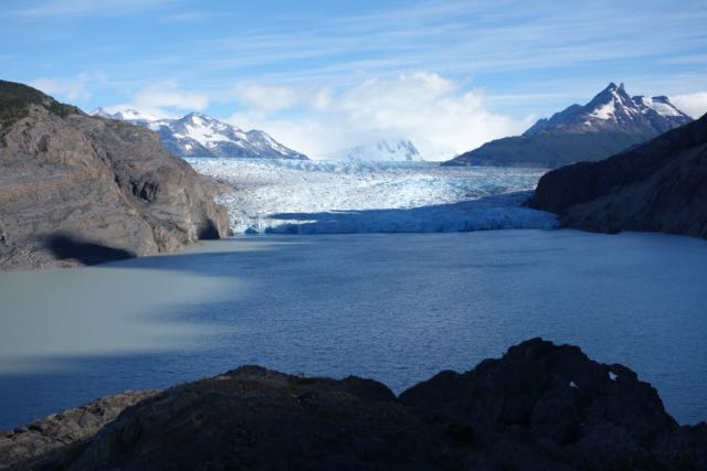
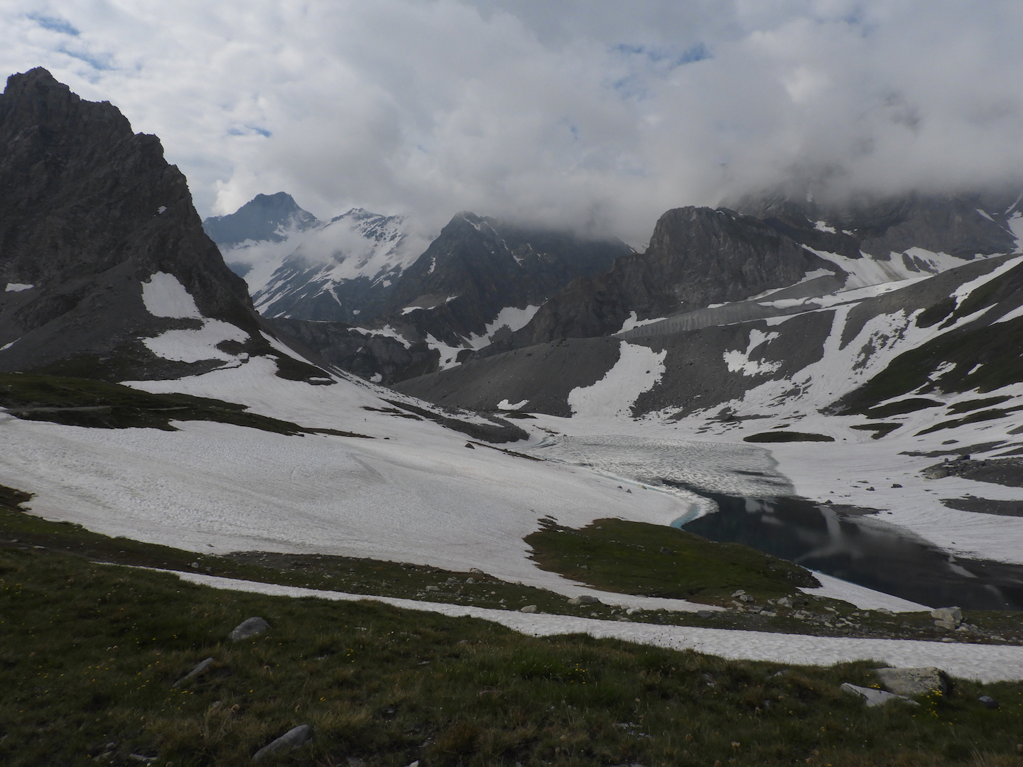
Tomorrow is a shorter day, heading to Paine Grande. We’ll spend much of the day humping up and down the ridge along Lago Grey, with the mother glacier shimmering like a dream over the right shoulder. It is a day of great views of the Patagonian countryside. Green lake, rolling russet hills, and Olympian peaks jutting out of the horizon. The timberline this far south is pretty low. The trail weaves through spiky shrubs and bushes crowded with red berries. Some are quite edible, Daniell says, but others will kill you quick. His English just isn’t good enough to be totally sure which is which.
Los Cuernos, the horns, is a trio of jagged peaks, striped with granite, that tower over this corner of the park. 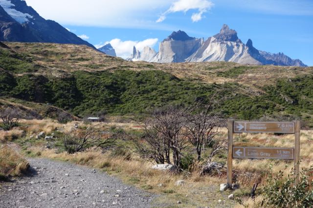 Its a long day, with an up-and-return along the Valle del Frances (Fran-CES). From Paine we reach Camp Italiano by late morning. Glaciers and peaks dominate the view to the left. Near Italiano is a big waterfall, thundering into a gorge. The spray hangs in the air like a veil. One of the group whose feet are in bad shape stays at Italiano while we make the trip up to Mirador Frances. Frances is an hour or so hike along the base of a tremendous hanging glacier. At the viewpoint – the Mirador – you can look back and pick up lakes stretching into the distance. Frances is very cool. The trail is virtually in the shadow of the glacier that sits high in the opposite wall. It “hangs”, which means it has plowed to the crest of the ridge, where it is suspended over the valley. It does not have a terminus in a lake, but looms like a frozen wave. A dozen waterfalls cascade down the mountain below it. Every few minutes we hear a rumble. It is not thunder. It is an avalanche. It is still summer and the snow grows heavy. We look up hoping to see one. But we are seeing only the leading edge of the glacier. Once a wisp of powder seemed to mark the moving snow, but it’s hard to tell.
The doughty Bay Area boys and their mom continue the extra hour to Mirador Britanico. But it is beginning to rain. There’s not much of a mirador if its raining. We head down the valley. It’s still hours to Los Cuernos where we camp.
I bought the porters a beer at Cuernos. They are a ruddy friendly bunch who don’t have three words of English among them. They are sitting on a low wall. Between the wall and the refugio is a patio of sorts, a gathering spot. It is also the trail, sort of like the road to town running through your kitchen. While we sip beer, hikers come through. In the bushes around the refugio, tents are pitched on platforms. There isn’t any flat ground. The refugio has a dining room, bathrooms, and a closet sized bar. Just downhill is the lago and a pebbly beach. Its a cozy place. Behind us the peaks glow in the evening sun. Clouds grab at the horns. They stop and gather. Maybe its rain. But the weather still holds.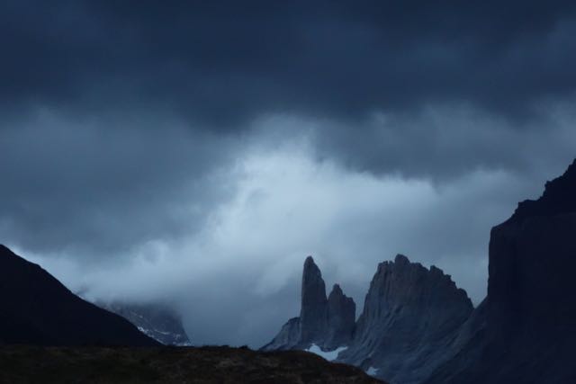 At Paine Grande last night the sky darkened and a heavy carpet of cloud rolled over the campsite. A few raindrops plopped in the dust. Daniell describes the difficulty when the weather goes bad. It rains hard, the wind blows, turns cold, and snows. The trails become muddy and slick. The guides rope clients across swollen streams. He laughs to recall a 75-year old woman’s profanity after being roped across a river.
The best is last. The Torres del Paine, for whom the park is named, are three peaks in the center of the park. They are huge granite pillars that can be glimpsed from various parts of the park, but never in full. The last day takes us up the Rio Ascensio to the base of the Torres. We rise early. We head immediately uphill scaling the flank of the valley. It is a form of Chilean torture to march us to the top of the ridge and then march us back down to the river. We take a break at Chileno and fill our waterbags. Chileno is a campground and a small building next to the river housing a few tables, a kitchen and a window serving coffee and wine.
We head back up to the ridge. The trail winds through a forest. It has a storyland feel to it. It is Lenga forest. The Lenga grows high with a full canopy, but has few low branches. Thus it feels both dark and wide-open at the same time – a place where the faeries might play. The trail emerges onto the sunny hide of ridge overlooking the valley. The opposite wall is impossibly sheer. It is more a canyon. The trail turns steep. We are climbing a rocky staircase, knotted with roots and bushes, grunting as we haul ourselves over the boulders. The trail spills into the open. There are tufts of grass, nothing more. The wind picks up, and gives us a sudden blast. We can hear it rattling the trees below. We look hopefully for the top. As we approach the top the trail vanishes into a trace over rocks. Here and there an arrow points across the boulders. The weather prediction was rain, but still our luck holds. The trail disappears around a bend and turns down. We are suddenly standing before a green lake at the foot of the three granite spires. These are the Torres del Paine. 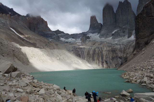 We find a spot sheltered from the wind and drop the packs. The clouds are moving quickly as the sun drifts along the gray wall. Christiane slices a pineapple and passes it around. It is a splendid spot, green water beneath a blue sky under gray peaks. Other trekkers have arrived and are lounging around on the rocks next to the shore. A few feet away a busy stream carries more water away. Too soon, the afternoon is upon us and we begin the long march home.
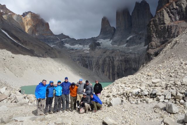
 It takes almost the entire day to drive back to Punta Arenas. We stop in Puerto Natales. In the tour office on a dusty side street is a dark room with a small table. Alongside is a smaller room with a couple of women at desks working the phones and computers. There are envelopes on the table where we stuff tip money. There’s no hustle to it. The guides are good fellows who earn every dime.
Alpine Summer
Posted on January 26, 2019 - Leave a Comment
Vanoise National Park
Hiking the French Alps
In the morning we set out from Pralognan. The village sits in a forested valley surrounded by peaks of gray granite. It’s a two hour drive from the stylish avenues of Geneva. The Latvian fellow who drove suggested the scenic route through Annecy, along the shore of a blue lake with small white sails. Above the lake against a green mountainside, harlequin colors swirled. Hang gliders passed over the road, landing on the beach.
Pralognan is a ski town. It has a couple of restaurants, a tiny grocery store (heavy on cheese) and an ATM. It is at the foot of towering mountains and has the flavor of the end of the road, which it is. There is one road in. There are no roads over the mountains. But a lot of hiking trails.
It was a sunny day and cool. Our hotel, the Edelweiss, is run by Thierry and his wife who staff the kitchen, wait the tables, cover the desk, and cheerfully struggle with the questions of hikers who speak a language they little understand. They make us sandwiches and see us off.
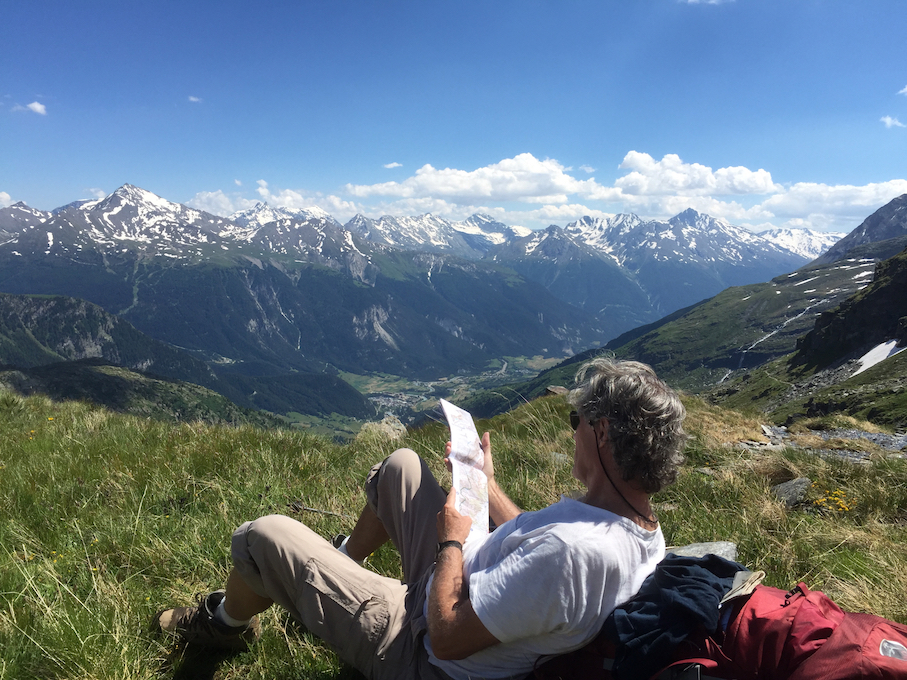
The map paints a clear picture. Col de la Vanoise, the mountain pass where we sleep tonight, is 3500 vertical feet above. We are headed up. All day. 
Call it cheating. We considered it opportunity. A few steps from Thierry’s front door a set of cables traced the giddy angle of mountain to an invisible platform up somewhere near the treeline. As we contemplate the cables, a gondola swings by. At a tourist desk, a woman pulls out a map and tells us good news. The ski tram, still running in summer, rises 600 feet and terminates a hundred yards from the trail.
We pay a few euros and climb on. The tram shudders and lifts away from the station. We rise almost straight up. The treetops fall away. We are soaring above the valley. Wow, this is steep. This would be tough with a pack.
The car thuds into the platform. We pull on packs and begin winding through the forest. In an hour we reach Barmettes, above the tree line. It is a refuge as they call them, an inn where hikers can find a room, a shower, even a bottle of wine. Most are staffed with gardiens, who prepare and serve meals. The food and wine are good – this is France. But we aren’t staying in Barmettes. We have reservations in Refuge Col de la Vanoise, at the very top, several hours away.
From Barmettes, we spend the afternoon scaling switchbacks and traversing sunny meadows, climbing steadily. It is surprisingly warm. At Lac des Vaches, a lake sitting in a bowl beneath slabs of granite, we stop to rest.
We are on a hiking circuit around the Glaciar Vanoise, which lies in the middle of the French National Park of the same name. Many of the peaks are still snowbound in July. But it’s summer, and the melt is in high gear. Water is pouring off the mountains. 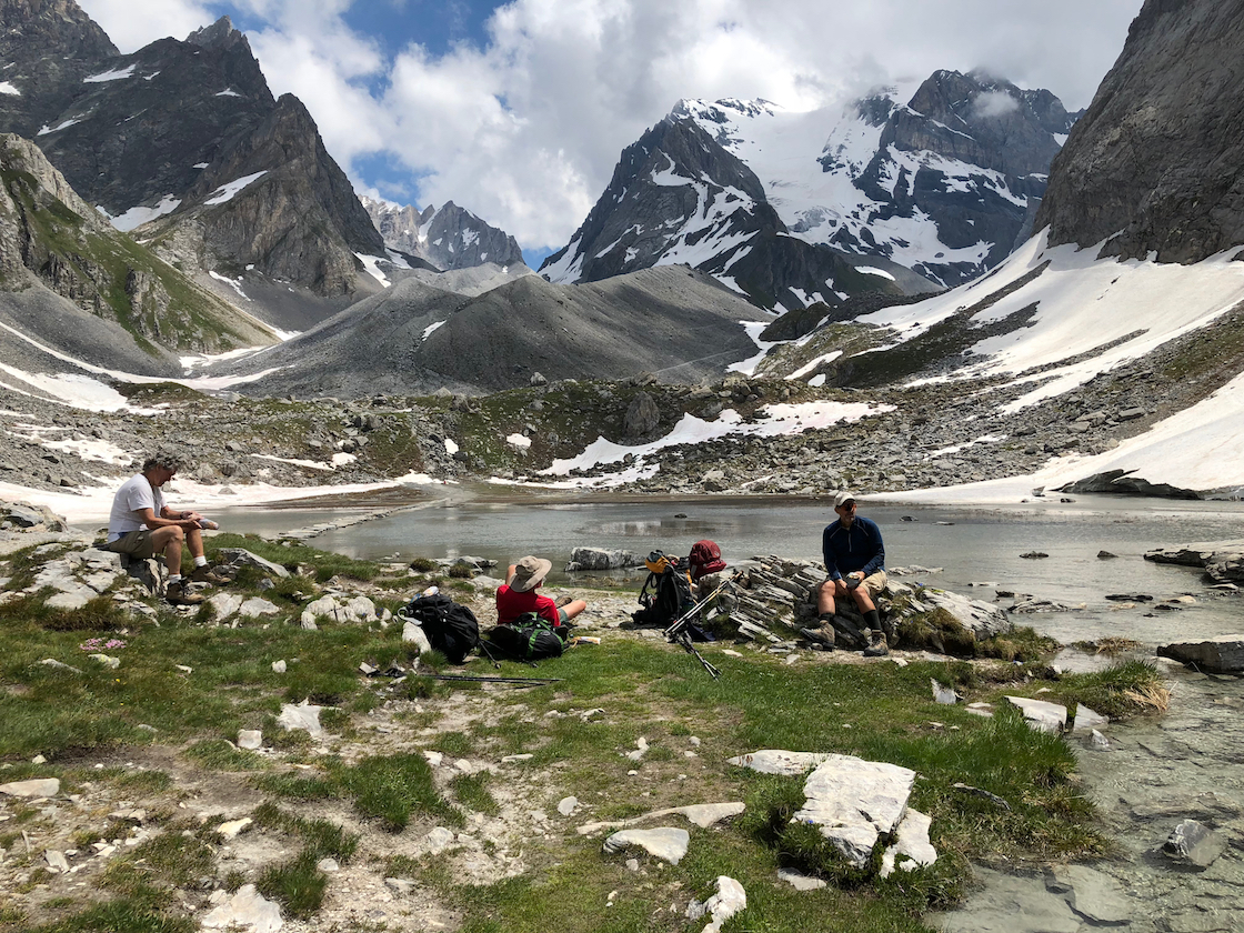
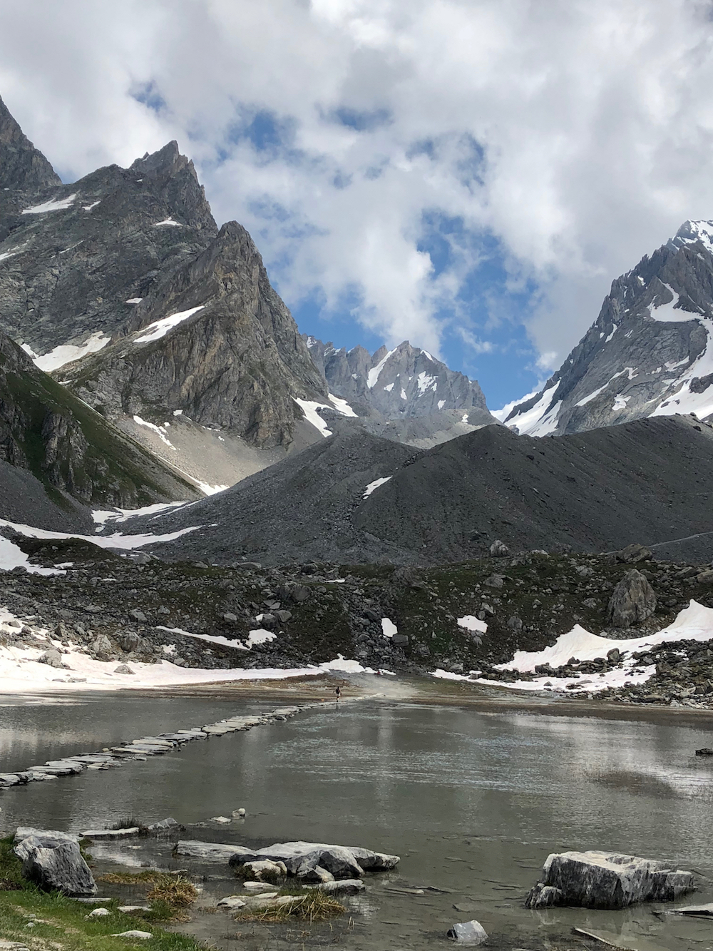 A causeway of stepping stones crosses the lake. On the other side the trail leaps into switchbacks which climb to a series of meadows. The path meanders through swells of wildflowers. The mountains are closer now, surrounding us in snowy summits. By middle of the afternoon, we enter the lower terraces of the Col – the French term for pass.
The meadows are streaked with snow. Soon it is everywhere, and progress is slow through what has become a winter landscape. A boot grommet catches a lace and I sprawl headlong. But it’s snow. I lurch back to my feet without a scratch.
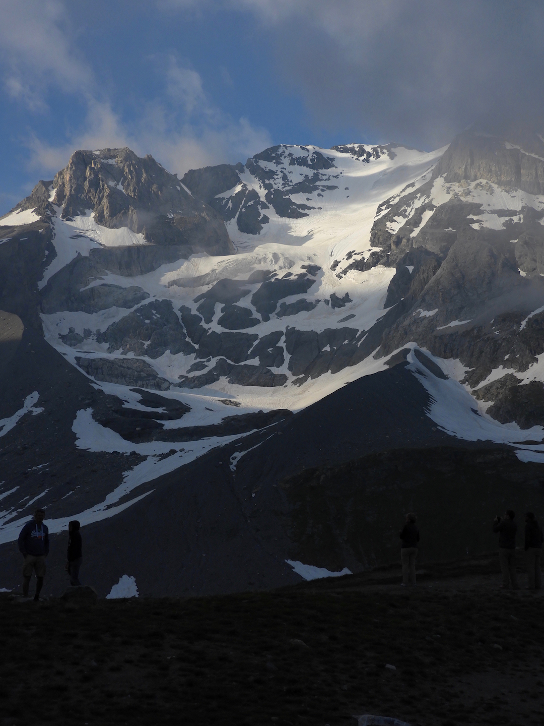 Higher, the wind picks up. The terrain is easier. The trail is a traveled path through the snow. It seems to stretch endlessly, gently climbing, weaving, disappearing in the distance. A hundred feet below a lake is catching runoff. We can see where the pass splits the peaks, which are not as high as before. Above are glimpses of Grand Casse, the highest mountain in the Vanoise, a fortress draped with a glacier spilling from the top. It is a dramatic river of white slipping down the mountain like ice cream gone soft.
Eventually le refuge comes into sight. It is a sturdy stone building with a large dining room on the first floor and dormitories above. At a table outside a fellow strums a guitar while a woman plays the violin. Clouds have gathered. Col de la Vanoise is one of the higher elevations, and acts as a weather bottleneck.
 It is the house rule to remove boots in favor of plastic shoes found in cubbies in the sous-sol, the ante-room in the basement. We drop the packs. The gardien assigns us a room. The French I’ve been working on isn’t going too far. She’s trying to tell me something I need to know. Nobody speaks English.
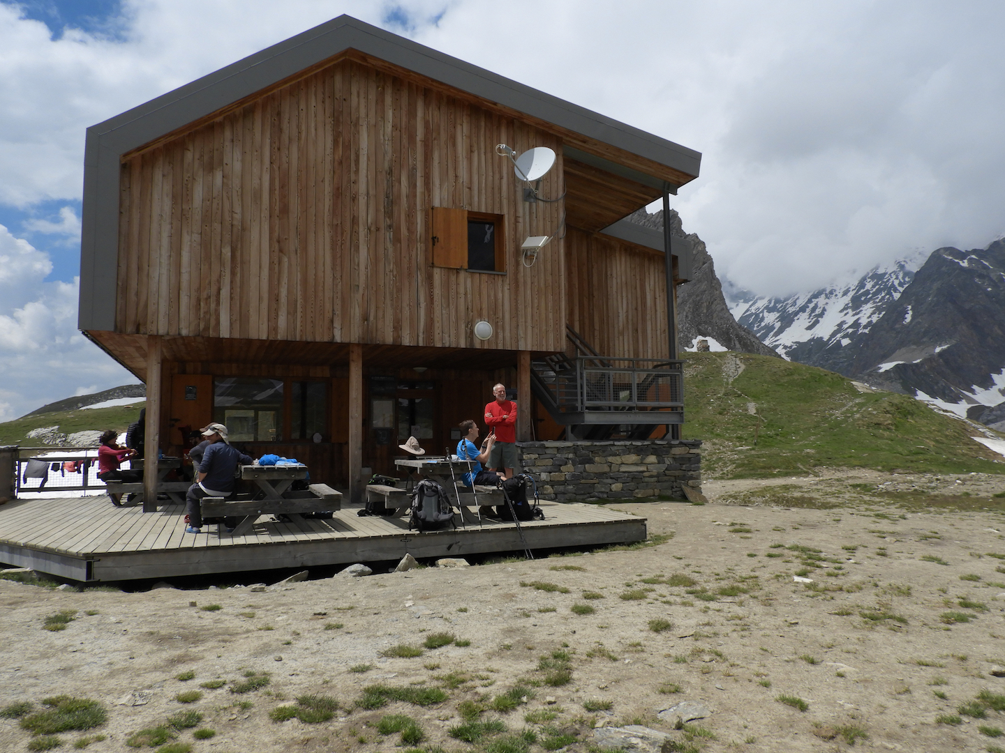
Dinner is at 7:00. Breakfast is at 7:00. Sept heures. It’s easy to remember. At our table is a French family from Brittany. There are no Americans, or for that matter English-speaking people. Vanoise is French. There seem to be more older people than young, all lean, gray, tanned and genuinely friendly. About the only other tribe we encounter are the Dutch, whom we keep running into. They speak some English.
Even in these rustic refuges, the dining has a French style. They pass a large pot of soup with bread, followed by a main dish. When that has been devoured, a tray appears weighted with slabs of cheese. Finally, they pass around dessert. And wine.
Although this is southern France, it is called Savoy, the Savoie, a mountain region between Switzerland and Italy. Its vertical geography has not meant independence, as it has in Switzerland, but has helped sustain a cultural identity. For centuries it was a bargaining chip tossed from dynasty to dynasty, but affiliated with none. Only in 1860 did Louis Napoleon’s Second Empire attach it to France. There are still calls for Savoyard Separatism.
But wonder. Why would anyone separate from France. Between the food, the wine and the people, it is hard to imagine living any better.
 Day 2. From la Vanoise, mercifully, there’s nowhere to go but down. We head to the other end of the pass. The sun is bright. Everywhere is water. It flows in small rivulets across the trail, into larger streams which pour over the rocks. It thunders under bridges in foaming torrents. In many places it has no definition. It moves almost en masse downhill, glittering in the morning sun.
 We emerge onto a flank of mountain, shrouded in snow. The trail through the snow – nothing more than a line of footprints – is midway up the mountainside. It is steep, steep enough to think about. Plant the stick, find a footing, and repeat. But something happens with our friend. He slips, loses his balance, and toboggans down the slope. He lands in a meadow, unhurt. But he, and the rest of us, are thoughtful. A hundred yards back, he would have bobsledded into the rocks.
The trail continues to weave along the flank of mountain. We are high up, halfway between the spiky ridge and the valley floor. There are places where the trail disappears into boulder fields, and then back into snow. It is slow going. The sun is bright, relentless above the treeline. From our vantage we look down a couloir – a narrow valley along which a tan ribbon of trail disappears in the distance.
That way is Val d’Isere, the eastern side. Val d’Isere, Jean Claude Killy and the three golds, an icon from my childhood. There is some magic to it. Where we lunch, another trail disappears into a sweep of valley toward the village of Termignan, to the south. Nearby, commanding a view of the several valleys is a crumbling stone structure, more of a stairhead, which disappears underground. It is a World War II bunker, so they say. It is an odd fit in this wild country.
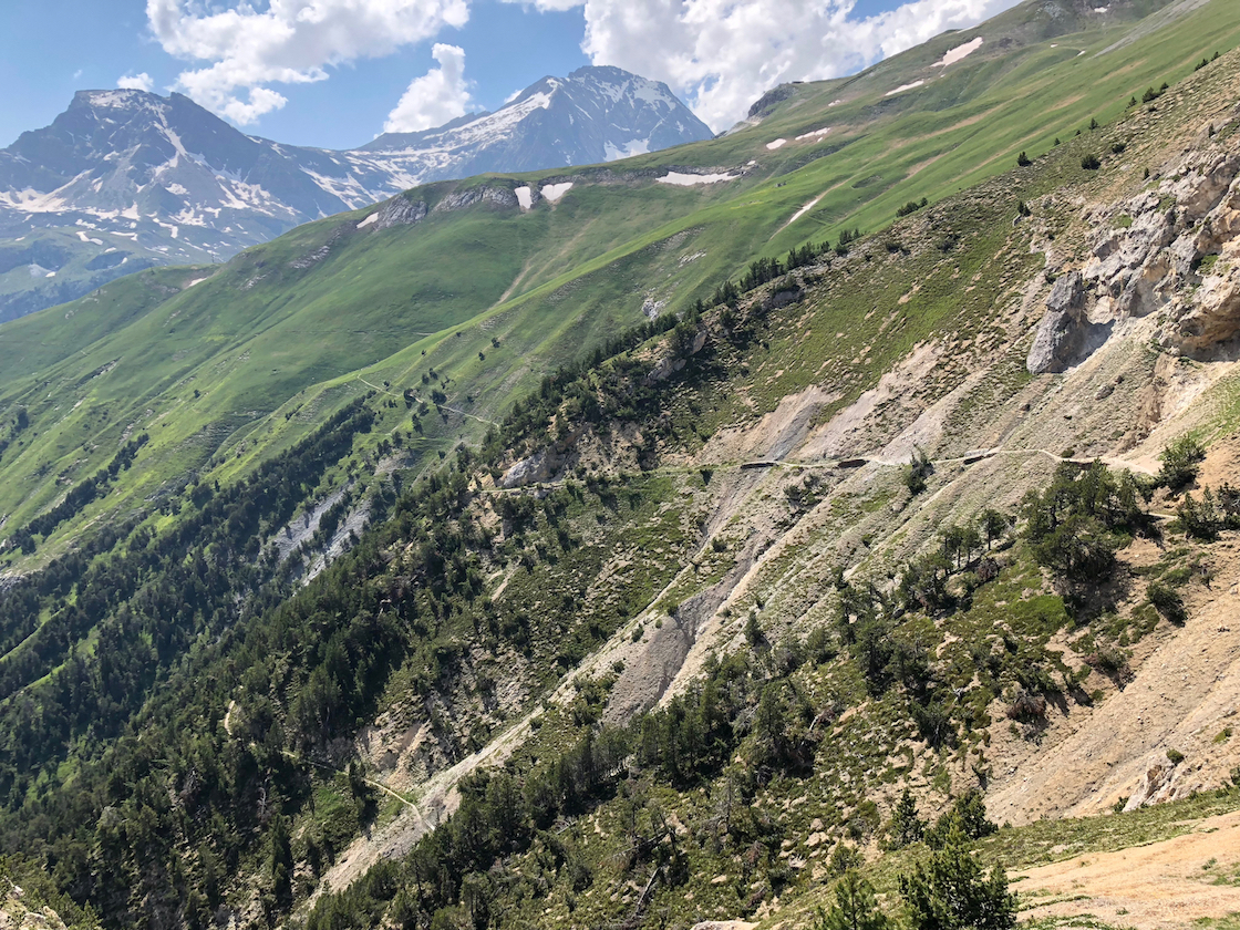
We spend the afternoon on a trail scratched into the hide of the mountain, overlooking a plunging valley – the Doron Gorge. We are headed to a refuge called L’Arpont. But something is off. It’s supposed to be 13 kilometers – 8 miles. At 8 miles we are not even close.
The terrain changes. We drop into a watery basin, more hard rock than meadow. The landscape is folded and fractured, carved by streams and flooded with melt. The trail has vanished, replaced by cairns – small rock piles – which point the way. We wander back and forth through this maze of brooding rock, squinting for cairns. Over an outcrop the trail reappears and disappears into the distance. This can’t be right. We should be at L’Arpont. The trail climbs again. There is no sign of the refuge. The trail is quite narrow and the topography steep. There is hardly a place to sit down, much less plunk a building.
We eventually descend, veer into a cleft, and there is Refuge L’Arpont. The refuge is several stone buildings, with a terrace, which seems suspended over the valley. It is a sharp drop into the Doron. Across the valley is a statuesque peak capped with a glacier, the Glaciar du Vallonett, which glows in the afternoon sun. After dinner we step out to the terrace. In the last blush of daylight, Vallonett has softened to a milky ethereal presence. These jagged, snowy peaks are never more surreal and beautiful than in the last moments of day.
 Day 3. The next morning we are headed to Dent-Parrachee, another 13 kilometers. From L’Arpont we drop into a meadow dotted with the ruins of defunct farms. They are old stone structures, roofs spavined, walls caved in. There are many. We can only guess that a herder economy, a livelihood of goats and sheep, must have taken a hit, and the farmers exiled to the towns that lie south, beyond the lash of Alpine winters.
Like yesterday, the trail winds up and down the flank of mountain. Occasionally we crest a ridge into another drainage. Mostly we follow the high contour of the valley south, surrounded by bare gray peaks. The sun is strong. The weather has been with us. A storm up here would be tough.
A patchwork of roofs is visible in the valley. A blue ribbon of river surrounds a village. It is miles away but translucently clear, magnified by the thin Alpine air. It is Termignan. Our friend who took a tumble in the snow announces that he’s leaving. He is a spooked by Col de Chaviere, our last day’s hike. Chaviere is another high pass and reportedly choked with snow. Jim has lost his enthusiasm. There was a junction for Termignan back aways. He’s heading down.
There were moments when I shared the sentiment. Just before lunch we stop a the edge of a real river and no bridge. A snow bank up a shady bend looks like it crosses. We slip and slide to the top, but it drops into the river. That’s Ken and Randall’s choice.
Downstream it is not so wide but the water is fast. It’s inevitable. I roll up pants and step into the current. My boots fill with ice water. A hop or two and I’m across. But now the bank. It is ten feet high and almost straight up. Upstream, downstream, the bank drops into the water. I’m a little trapped. There’s a handhold here, a foothold there, but nothing to pull me over. A slip and I’m in the river. That would be no fun. Finally, with a foothold, I reach overhead and grab at a handful of grass. There’s nothing else. But it’s a sturdy Alpine grass. One more handful of sod and that will do it. I crawl over the top, on all fours, panting like a dog. Randall and Ken are stretched out in the sun, boots off, nibbling sandwiches. We were starting to worry about you. Yeah, I can tell.
 There is no guide for this type of trek. We hired a company to reserve the huts and supply us with maps and “notes” that describe the trail. This company apparently hadn’t done much guiding in the Alps. The notes are almost useless. It says it’s 8 miles to Dent-Parrachee, which is higher than L’Arpont, with a steep climb at the end.
By mid-afternoon, we passed the 8 mile mark. But nowhere near Dent-Parrachee. We hadn’t even seen a sign for it. I’m out of water. Not usually a big problem. There’s water everywhere, but none close by. In the distance is a finger of snow and a stream splashing over the trail. Another crystal clear mountain stream – but no. This one was thick with sediment. Still, it’s snowmelt, so hopefully no disease. The water is a brown cloud in the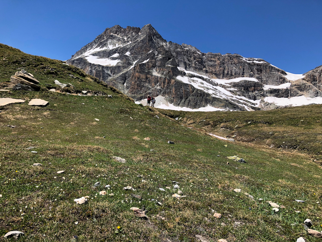 bottle. It actually has a sort of pleasant tang.
The trail stretched on. Ken and Randall are ahead. There is a wall and what looks like the end of the trail. It seems to stop, but instead drops abruptly into a maze of switchbacks which end in a meadow way below, so far below that I can’t tell if the two figures down there are my friends. It was depressing. We’re not sure where we are. An hour later, around 5:30 – nine hours since leaving this morning – we pass under some sort of ski lift. There are cables overhead. We’re pretty whipped.
There’s a small yellow sign for Dent Parrachee, 1 hour away. But that’s fantasy. In the fatigue, we’re taking breaks every few minutes. Dent-Parrachee is a steep climb, and the junction itself is more than a mile off. It would be past 7, dinnertime, before we arrived.
But we spot another sign for something called Refuge Plan Sec. We caught a glimpse of roof over the brow of the hill. My French is awful, but it’s all we got. I trudged like a convict up to a stone building where a man and woman were sitting in a small courtyard.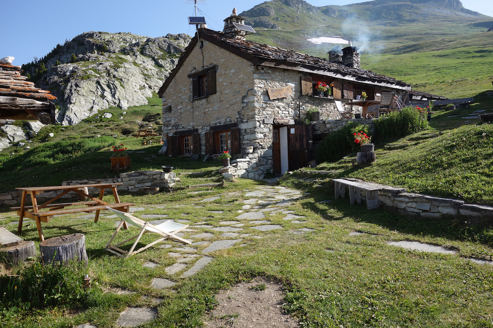
Etes-vous la proprietaire? I asked. Oui, she said. She’s the boss. Avez-vous des lits (have you any beds). Oui. Et diner? Bien sur, she replied. What good luck. We could take our packs off. We could stop walking. I tipped my head back in relief and muttered for the benefit of my saviors “Vive La France”.
They gave us a huge room, more of an attic, dark with old wood and low timbered rafters. It had no electricity but no problem. We wouldn’t be up that late. We had it to ourselves. The property had been in the woman’s family for two hundred years. In the winter, abandoned for the season, the bar and restaurant on the first floor lie under nine feet of snow.
In the small bar, the French woman appeared again. She was also the barkeep. I asked for a beer. Simple. There’s one tap. And of course, it’s France. Even the beer is good. 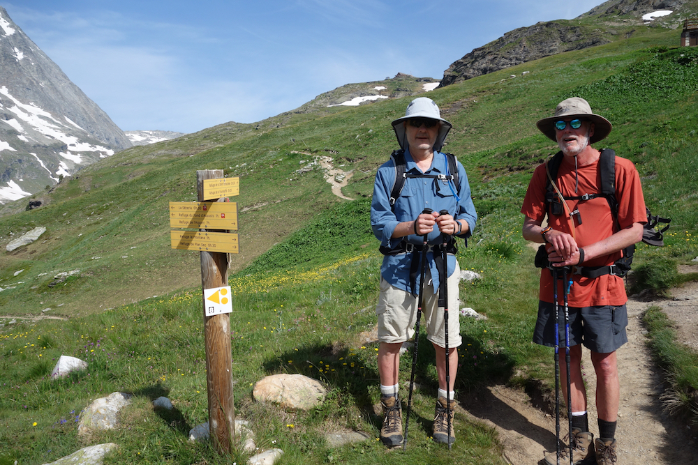
There was only one other group at Plan Sec, from the Netherlands. The Dutch again. They spoke passable English. We ate dinner together at a large table by a cavernous fireplace. The lights were dim. They run off a generator. The French woman brought out dinner. Soup, of course, followed by a bowl of potatoes and sausage. Then slabs of Beaufort cheese. A Savoyard dinner.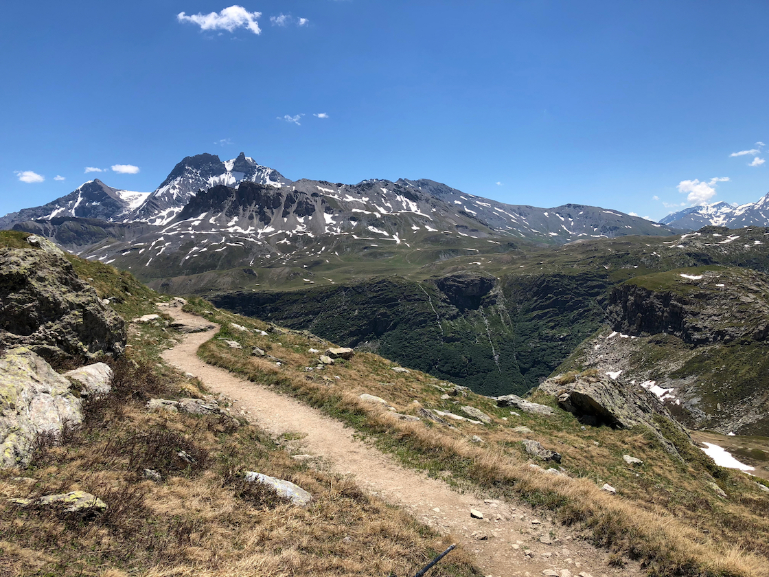
For dessert, she turned down the lights and served a creme brulee, flaming blue with a local liquor made from the Genepi flower. I suggested that this sort of liquor was strong for American tastes, but was no doubt mother’s milk to the Dutch. I don’t think my edgy humor translates well.
Day 4. We are headed to Refuge Orgere. From Plan Sec the trail follows a vehicle track above a deep blue lake. A mile farther the trail branches. One route heads uphill to Dent-Parrachee, yesterday’s destination. Another bends toward Refuge Fournache, visible high up in the meadow. This is ours, which doubles back behind the lake. Once again we are climbing. The lake is virtually a sheer drop. It is steep geography.
 The trail is safe but dizzying in places. After a couple of hours we circle the lake and branch off into a grassy meadow, the Col du Barbier, another pass. Barbier is not so high as Vanoise. Our friends at Plan Sec have packed us a bag lunch. We stretch out among rolling waves of yellow and purple flowers. The sun is warm. I could sleep.
Refuge Orgere is at the southern edge of the park, about a 1300 foot vertical drop. We hike down and down, leaving the open country. We enter a shelter of conifer forest. The switchbacks are tough on the knees. But we’re not complaining. It beats the heart-pounding, sweat-pouring toil of climbing. We reach Orgere in late afternoon.
Our Dutch friends appear again at dinner. I have washed a shirt – wash it or burn it. And have hung it outside. Predictably, hanging it to dry alerts the rain gods, who dispatch the first really wet weather we’ve encountered. I had also tossed a few socks and shirts over an outside railing at the top of the stairs. There are a few big splats and then while we eat, it pours. When we head to bed, I find a pile of dry clothes on a bench by our door. Someone retrieved my clothes before the rain and folded them.
Day 5. The trek to Refuge Pecolet Polset will be a challenge. It lies the other side of Col de Chaviere, reportedly snowbound. It snowed quite a bit this year and has not melted high up. From the first step at Orgere we head straight up, plodding back and forth among the switchbacks, soon drenched in sweat. We ascend through a pine forest to meadow. Ken and I are together. Randall is up ahead, impatient I’m sure with our lingering. Randall is a corporate guy, focused, goal-oriented. On the other hand, I want to enjoy myself, be in the moment, savor the sweetness of life. Which is to say Randall’s in better shape than I am.
 Through the morning the path weaves through Alpine meadows. The treeline is far below. The mountains rise in lofty pinnacles, called aiguilles – needles. They catch wisps of cloud like rags. It is a fortress of snow-capped summits.
 In the distance we spy a breach in the wall blanketed in white. It has to be Chaviere. We have to hike over it to reach Pecolet Polset. But it is far off, a couple of hours. We crest a ridge and descend into a boulder-strewn flat threaded with streams. The Col is closer now and more distinct. We parse it to see if the trail will take us high or low. This was Jim’s concern, a slippery trace high above the valley floor. The distance is deceiving. We cannot tell.
We climb over another hill and come upon a couple staring through binoculars at the ridge above us. They have spotted an Ibex, with large horns, something like a Bighorn Sheep. We spot him on a rock at the top, his horns silhouetted against the sky. He appears to be looking down on us. It is a grand sight, a prince of the Alps, gazing down from the crags. They live only in the upper reaches, among the cirques and ridges. It is the preservation of this endangered animal which gave the impetus for the Vanoise Park.
The trail weaves through more meadow. The Col is now overhead. We squint for the tiny figures of other climbers. We can’t really see a trail. The meadow has widened and the wind is stronger. The trail seems to veer away from the base of the Col, around to the right. Time for a wardrobe change. I am sweating with the climb, but it is suddenly cold. In a snap, it has gone from breezy summer to chill winter. I pull off damp shirts, and pull warm clothes out of the pack.
In a few steps the trail tips up sharply into switchbacks, swerving in and out of snow. It has grown steely gray as weather pushes into the pass. The summit looks far off, but more above than away. It is impossible to tell how far. Thirty minutes, an hour? I have lost Ken, who is somewhere ahead. 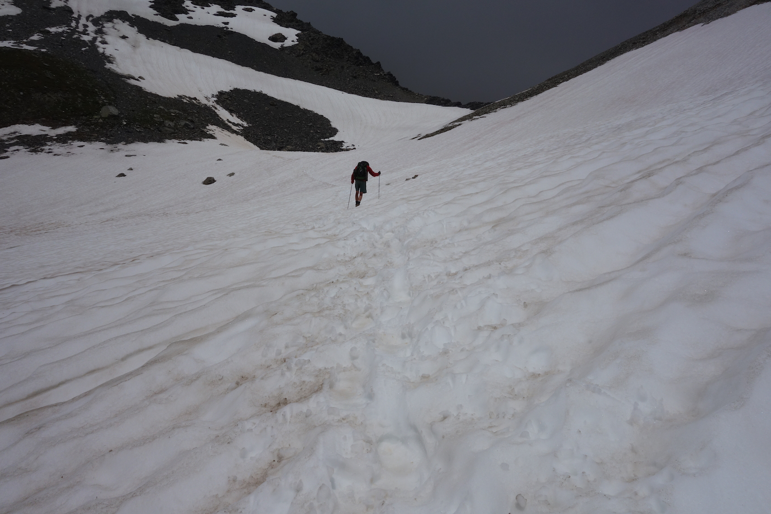
It begins to rain, but not hard. The switchbacks are like stairs. I catch up with Ken. He’s waiting. Better to be together. Ahead is the snow we heard about. It’s white from here to the top. We have somehow flanked the Col and cannot see it, but there are footprints. Good enough. We slip and slide, clambering around outcrops, sure of nothing other than the trace of prints in the snow. Up we go.
There is no destination at this point, just a white passage stretching before us. We are crossing our fingers against the rain as we jab one foot in front of the other, testing the hold. We do not want to fall. We look up and see Randall. His arms are outstretched. He must be at the top. The rain which threatened a few minutes ago has yielded to a fierce wind. We are close. We slow as the pitch of the mountain grows more steep. I am watching Ken’s boots, then my own. There’s no looking down. My oxygen-depleted brain would go dizzy in the gray light. We plant each step. Each footfall brings us closer.
We look up and Randall is standing above us. That’s it. The wind is terrific. Its time to celebrate, but not much place for it. A small plaque, a tiny patch of dirt amid a crowd of jagged rocks, barely a proper seat. But we don’t want to sit. We’ll stop below. We take a few quick photos. In moments we are stepping carefully over the rocks heading down.
 The descent is almost as bad as the climb. It is steep, each step occluded by rocks. There’s little trail to speak of. After both Ken and Randall take a tumble down an invisible ice patch (which I avoid by grace of their example), we lose all sign of the trail. We stare into a snowy bowl. It’s steep and no footprints. I’m not doing it. We wander a bit, looking for clues. We swing left over some boulders where the terrain drops out of sight. On the other side, a shallow trench of disturbed snow is what we’re looking for. We follow the prints to a rocky ledge where we drop the packs. Time for lunch. I hang a wet shirt in the rocks. The sun has returned, dry and warm.
But in the valley the sky is growing dark. It is an evil gray and moving toward us. This looks like a storm. We pack up. It would be nice to be out of the snow before it arrives. But the clouds press in, spit a little rain and are suddenly gone, just like that.
Pecolet Polset is all downhill. I pause at the head of a steep white slope. We can see Refuge Pecolet Polset in the distance on a brow of rock. This would be slow going, but instead I drop my fanny into the snow, lean back on my pack and let go. I fly to the bottom, where the grade tapers and I can stand, a little wet. Surely the trail is here somewhere.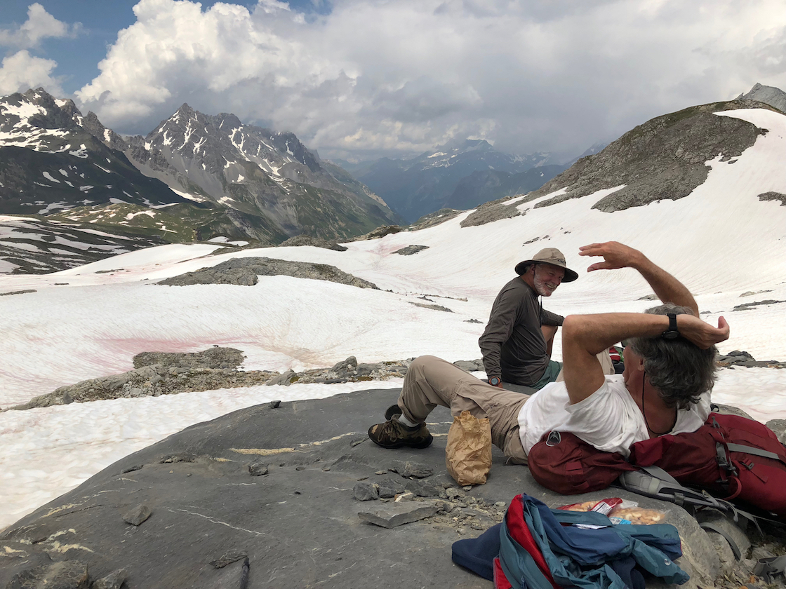
Day 6. Back to Pralognan. The evening in Pecolet Polset was pleasant. Today there are no torturous climbs over slippery passes. Its downhill. The trail is a two-rut dirt track, broad and gently descending. There are more streams pouring out of the mountainside, making us hop rocks to stay dry. We encounter a lot of day-hikers. We hear our first American accents. A group from Indiana, headed for a night at Pecolet. We are now out of the park and in Savoy farm country, a land of dairy cows and cheese goats.
We hear a racket above. In a tilting meadow is a herd of cows and men shouting. It is hard to imagine how they got there. Mixed in the din is the sound of dogs. There are several herder dogs darting back and forth, yapping non-stop at the cows.
What has now become a country lane bathed in morning sun dips toward a pasture and small stone buildings. They are milking sheds and stalls, and one building where le fromage de chevre – the goat cheese – is made. An old Frenchman approaches me and we chat, or try to. He gestures to the twin peaks behind me, where a glacier hangs between two rock pinnacles. It is Pecolet Polset, where our refuge got its name. Not Pol- SAY, as I am pronouncing it in my pidgin French, but Pol-SETT, he instructs. Above, way up top is Genepi Glacier, a blanket of white sprawling across the high horizon. At this angle of the sun, it is glowing, alive, hard to grasp with the eye.
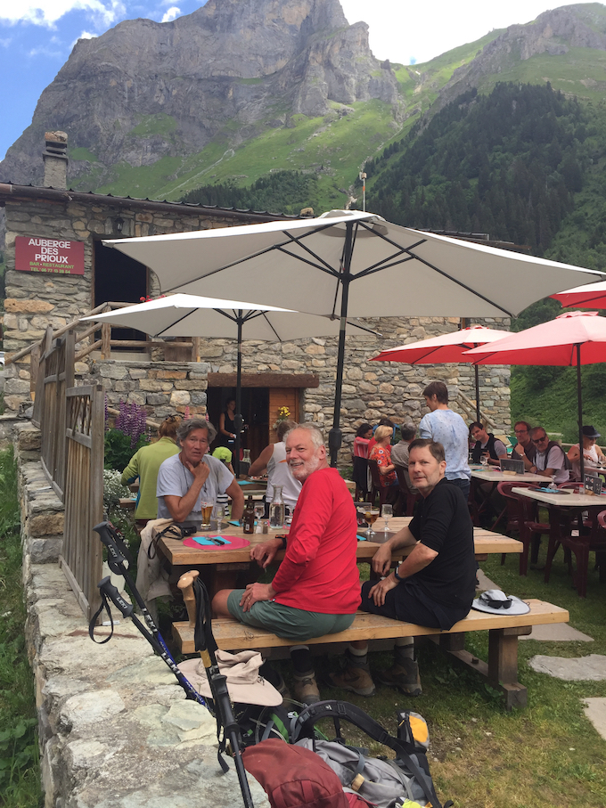 At a pasture full of cattle, their chestnut hides shining and bells clanging, is Refuge du Roc de la Peche. It has a few outdoor benches next to a small stone chapel. We stop for a drink. It is Alpine summer here. Further on, in the village of Les Prioux, is a restaurant with a large and crowded outdoor café. There is a bus that serves Pralognan, which is still an hour away. We’re thinking about it. But the bus won’t be here for more than an hour. We have lunch, grab our packs. We are soon in the forest.
The trail descends abruptly, almost dropping us into Pralognan. Across town we see the cable car lofting into the sky. The days have merged. But today’s date is easy. Our return to Pralognan is July 4th, American Independence Day. There will be no fireworks in Pralognan. But as we approach the Edelweiss, Thierry steps onto the porch waving the American flag. He has hung it in our honor behind the reception desk. At dinner he plays some American music through the tinny dining room speakers. It is modern American pop, so it’s pretty awful, but it’s an uncommon gesture of friendship. 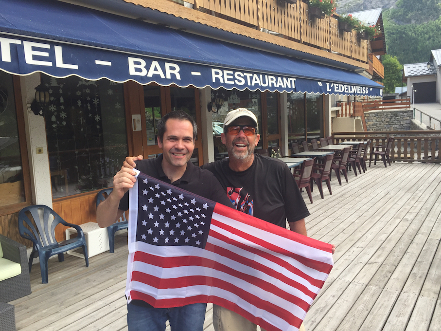
His English is not so good, but he surprises us with his research. Throughout the hike we tread through a lot of snow tinted red. It’s a mystery. Pollen maybe? Bacteria? We ask Thierry. Le neige rouge .. pourquoi? He appears at our table later to explain. It is the Sahara. We are in the south of France, close to the Mediterranean Sea. The wind blows north from the desert. What we are seeing in the snow of the Alps is the dust of the Sahara Desert.
Tom, the Latvian, appears in his mini-van, and we are headed back to the cobblestones and chapels of Geneva, the city of John Calvin and Rolex. My friends head home. I’m waiting for the train to Montreux.
The Atacama Desert
Posted on October 7, 2018 - Leave a Comment
Trekking the Atacama
The Highs and Lows of the Chilean Desert
Cliff Lancey
My friend and I were sipping wine beneath an Algarrobo tree when a tall fellow crossed the courtyard and introduced himself. His name was Wilhelm, a German Peruvian from Argentina. He preferred to be called Billy. Billy was working as a freelance guide. The Chilean border is pretty open to Argentine passports, but not for work. This job, Ken and me, he let us know, was just the other side of the law. No problem, he assured us.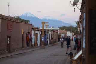
This is San Pedro, a town in the Atacama Desert. We crossed the desert from Calama a few days ago. Much of the scenery has a patina of white – salt – except for the snow-capped mountains. The Andes rise so high it is hard through the haze to tell the white peaks from the clouds.
Calama is a mining town, a remote corner of the extraction industry that is a major part of the economy. The road from Calama runs straight as a string through the desert of the Atacama.
We are in what was once Bolivia. The two countries fought a war – the War of the Pacific – over the nitrate deposits. Bolivia lost. The desert and the seacoast to the west have been part of Chile ever since.
The outskirts of Calama are monochromatic in the blistering afternoon sun, brown apartment blocks the color of the desert beyond. It is North Las Vegas without the charm. The personality of the desert changes with the miles. Outside Calama the table-flat plain changes to lumpy red hills and broken cliffs.
A dust devil spins across the road and flies apart. In the distance a solitary transmission line runs obliquely to the horizon. As we climb, clumps of yellow grass start to dot the roadside. There is no other sign of life. The few dessicated plants, we read, draw moisture from fog. It never rains.
We ascend a plateau. The mountains that seemed so far away are nearer now, looming high against the sky. Most are in the shape of cones – the hulls of old volcanoes.
At the top it seems like the desert unfolds before us. It’s a landscape from science fiction, empty surreal distances stretching to the horizon. In the middle distance the land is broken into canyons and spiky outcrops. Beyond that, nothing, a whiteness gone to haze. The road winds through a corridor of rubble into a shady cut where hoodoos stand at attention; then out again onto the sun-blasted plain.
Finally there’s a village, its narrow lanes hemmed by rock walls. The vehicle lurches to a stop in a cloud of dust. The driver yells Takha Takha, my hotel. I am half asleep from an overnight flight, the altitude, the torpor of the desert.
A carriage door swings open onto a courtyard. Inside are trees and welcoming shade. Ken greets me, a glass of wine in one hand, a cigarette in the other. He pinches the cigarette between his lips to grab a bag. Welcome to San Pedro de Atacama, he says, the garden spot of Chile.
San Pedro is an oasis town. From the cliffs above the desert floor, the village is a green patch on the bleached hide of the Atacama. It is at once fascinating and appalling, a wasteland of salt flats and spiny gulches, a canvas stretching to the horizon in a palette of bleached brown. In the distance, beyond the rooftops, is the salar, the Atacama Salt Flat, stretching to the south. Rising beyond are the mountains, defunct volcanoes, the impossibly high country of Bolivia.
The village is watered by the slender thread of the Rio San Pedro. It begins in the Altiplano to the north and expires just a few miles south in the salt flat. A network of small aqueducts carries the muddy water into fields and courtyards. There is a schedule and a day when they turn a tap for each part of the village. The concrete channels, most no more than a foot wide, are the margin between the tolerable shade of the Algarrobo trees and the parched void that lies beyond.
Aside from a one-lane dirt strip called Caracoles where the tour agencies and eateries cater to the Chilean tourists, the town is a scorched jumble of adobe homes and walled yards pressed up against the dust-choked streets. Sheets of corrugated metal, some held down with rocks, keep out the rain.
But rain isn’t much of a problem. It rains so little in the Atacama that its ecology has been studied as an approximation of Mars. Science suggests that if microbes can live here, where it hasn’t rained in a hundred years, they can live on Mars. To witness the barren sands stretching in every direction, I can see the point.
The darkened entries of the small storefronts all have sign boards plunked in the dirt advertising geysers, volcanoes, lagunas, sandboarding, and super “ofertas” for the Valle de la Luna. The Valley of the Moon. Nobody speaks much English. I have been trying to learn some Spanish. I’m about to find out how much.
The idea of tourism is dissonant in a place like this. Tourism connotes something almost religious in its consensus. Tourists come to see what other tourists have seen, to be awed by the majesty of El Capitan, the brazen distances of the Grand Canyon. It’s all defined and filtered, reduced to a simulacrum of real experience. Seen so often, these places are no longer seen at all.
Then there is this wilderness of desert. For several days we saw no one. Not another hiker. These austere distances are on no one’s bucket list. The motive to travel here is more idiosyncratic, to find something different. In making sense of the place there are mostly blanks to be filled in. There is a tug of a primeval wonder.
We’re not sure why we’re here. It’s almost a joke. Neither of us can quite remember whose idea it was. Part of the answer I think lies in our lost kinship with nature, an urge to make contact with what lies beyond the frontier of comfort and familiarity.
The narrow, dusty lanes give San Pedro a primitive, time-forgotten quality, though virtually every hut has a satellite dish, and every worker seems to have a tool in one hand and a phone in the other.
The images of urban culture permeating the world’s far corners are said to be the root of social unrest. But there are few signs of Maoism in San Pedro. Billy is the closest thing. A socialist, a proud beneficiary of the Argentine welfare state, but happy enough to confess that he detours his money through Germany to avoid the welfare state taxes.
The political winds blow a little differently he says. Elsewhere in the world the indigenous people live in communities of poverty and despair. In San Pedro, the Atacamenos, the ancient people, are the ones in charge. They are certainly a race apart from the Chilean women, the tall, dark-eyed beauties who have perfected the Creole ancestry. The Atacamenos are short, thickset, with round dark faces.
At a security point a young Atacameno in a green uniform looked at Billy’s permit. He was short but powerfully built, with a broad face, his expression indifferent behind wraparound shades. His jet black hair was shaven on the sides, but long on top and tied in a flowing top knot. He did not look like a guy to mess with.
The women on the other hand, even the young, are plump and figureless, with the symmetry of an oil barrel. Although the Chilean women enrich the landscape, every tienda, bodega and bar seems to be run by the Atacamenos. In a land whose oppression by the Spanish has left an indelible stain, it is hard to imagine how they pulled it off.
Down a winding lane, the tour companies and shops in the village center yield to pastures and vacant yards. In a land of few trees, the Atacamenos build with rock. Every courtyard lies behind a rock wall. There is an air of seclusion. Living at the edge of such a boundless, lifeless expanse, there must be a craving for scale, privacy, the reassurance of close and ordered space.
At the end of one road I head down another which runs to the edge of town. The walls and yards end. It happens quickly. Here a house, a courtyard; there but a hundred yards away, the end of civilization, an infinite vista of sand and salt. Nearby, a wind-break of some sort has not worked out. A line of shrubs planted in the uptipped cavities of cinder blocks has gone wilted and brown, a forlorn screen of withered sticks.
 Where the road bends around a shady corner, there is a commotion of some sort. The road is full of goats led by two donkeys and followed by an Atacameno herder tapping the ground with a stick.
I step past a woman walking a large dog to get closer. The hooves make a muffled clattering in the dirt. The donkeys are now even with me. I stroke them on their hard, hairy snouts. The dog goes suddenly ballistic, lunging and snarling, his teeth flashing, the woman wrestling with his leash. The animal is completely out of his frame and has not ruled me out as target preference. I slip sideways patting the donkeys, preferring to be nibbled by goats to being devoured by this mastiff.
On the map, Rio San Pedro lies up a nearby road at the outskirts of the village. The afternoon heat is wilting. Like almost all of the streets Calle Domingo is unpaved and the dust is awful. Each bone dry dirt track I wander seems to attract a convoy of traffic. A bus and two SUVs pass. A miasma of dust billows from the bus. The SUVs add their contribution to the mushrooming cloud. Nobody seems much distressed. They bicycle through this tempest as if it were nothing.
In the morning we head south to Toconao and up to the Altiplanico lagoons. Reaching east and north into Peru and Bolivia is the Altiplano, the high plain of the Andes. The Altiplano rises to remarkable elevation. We criss-cross it several times, from a manageable 10,000 feet to an enervating 14,000 feet. It is literally sickening – at least to me.
Between Ken and me, it is I who is the weak link. I sag at 14,000 feet, head-achey, dog sick, usually followed by a zombie-like coma, from which I emerge a day later my winsome self. Ken is a good friend, and has agreed to hang around San Pedro a few days to let me get acclimated – basically so I don’t screw everything up by getting sick.
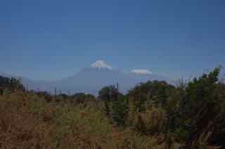 On a rising scrub plain above 11,000 feet we leave the pavement and head east, winding into the mountains. Not too far away is ALMA, the large radio telescope. The stars are bright out here, enhanced by the elevation and lack of water vapor. Licancabur, a postcard perfect volcanic cone on the Bolivian border, dominates the sky. The peak is more than 18,000 feet high. It is huge, visible almost everywhere, worshipped by the Atacamenos, they say. Nearby, steam rises from Volcan Lascar, one of the few active volcanoes.
We approach a ridge of golden hills. The pale thread of road slips out of sight up ahead but reappears as a thin line tracing the top of the ridge. I am growing sleepy with the altitude which is approaching 13000 feet.
The Miscanti Laguna and it’s sister Mineques are cerulean blue, pendant jewels in a setting of salt, surrounded by snowy peaks. The opaque blue water is hypnotizing, ethereal as a cloud yet with a density like a bowl of paint.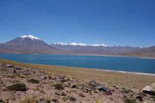
The lagoons are saline and support little life beyond tiny brine shrimp. But the shrimp are the staple food of the flamingoes, who flock to the shallow waters. Los Flamencos are a big tourist draw.
Salt is everywhere. We visit a cavern whose dusty brown walls belie that the whole thing is salt. Press the wet end of a finger into a crevice and it comes back salty. Walls of salt groan and crack in the afternoon sun.
The trek begins. Billy picks us up in a small truck with two other guys, Ruben and Ariel. Billy is the only one who speaks any English. We heave our bags in back and jam into the truck. We head north into the desert, climbing away from San Pedro. A few miles in, the road disintegrates into ruts cut into the hard dirt the color of dishwater. The truck stops. We seem to be in no discernible place. The thought crosses my mind that they could rob us and kill us. Not even the birds would find us out here.
But Billy, we are learning, is a good fellow, and suggests we walk slowly at first to gauge our acclimatization. Even with some imagination there is nothing that suggests a trail. As if in some existential reverie, we simply start walking toward nothing. We climb to a cliff and follow the ledge which becomes more or less the route.
Beautiful may not be the perfect word for this tough, hostile landscape, but it is nevertheless a place of awe and even mystery. From the cliffs we look down upon the Valle de la Muerte – The Valley of the Dead.
The floor of the valley is a warren of sand dunes and rocky spires. It is all sand and rock and stony gravel baking in the sun, a no-man’s land. There isn’t a tuft of grass. Dry and desolate, yes, but not exactly dead. On a far off sand dune we make out people. They are sandboarders. They strap themselves into what are really snowboards, and catch the dry waves.
We come to a place where an enormous dune rises to the lip of the cliff, Billy hops into the sand, and we descend. We climb up and down the dunes, our boots filling with sand. It is a challenge. The sand is moving underfoot and we with it. Ken and Billy look like survivors of the apocalypse staggering over the empty dunes. Finally we slip down into a gravel wash, winded, and stop for a drink. No one said crossing the Valley of the Dead would be easy.
For a morning we crash around dry river bottoms in the truck. I am growing fond of it. My yen for a little adventure is matched by an affection for tossing empty beer cans in the back of a pickup. But there’s not much room back there. The bed is piled high with trek equipment. The gray vehicle looks vaguely like an elephant with a rounded hump of equipment bundled under a bedraggled gray tarp
Our first full day is to climb. We are already at 11000 feet. We walk slowly. Even a couple of brisk steps leaves us breathless. We spend the morning climbing to 13000 feet. Even with just daypacks, it is exhausting.
Camp appears to be wherever Billy decides to stop. There are no campgrounds or fire-rings or shady groves; there’s nothing. We pull off among the outcrops. One place looks as good as another. We smooth the rubble and pitch a tent. Billy and Ruben set up the kitchen tent, that looks to be about a hundred years old, but serviceable. They haul a couple of large coolers and boxes, and unfold a table.
As Ken and I put up the tent, we discover not ten feet away a panel of petroglyphs on a large rock, a suite of animal figures and totems etched into the stone eons ago.
Billy sets up a cook stove. He slices a melon. A bottle of wine appears. Billy slices tomatoes, onions and avocados while something simmers in a pot. Dinner is humita, a Chilean dish of raw vegetables over a cornmeal tamale.
It grows quickly dark once the sun sets. Dinner over, we step outside the kitchen tent. The night sky is flooded with stars, so close they seem within reach.
Next day we are in the canyon of the Rio Grande, a tributary of the San Pedro. The sun is bright. We hike nearly all day through a gravelly wash, crossing and re-crossing the shallow river.
This is the Altiplano, almost as dry as the desert below, but braided with small streams draining the summer melt of the mountains to the east. Most of the river bed is dry and choked with rocks and boulders. There is no trail. Billy wanders ahead, climbing boulders, scouting a path. The boulder hopping is tiring.
Higher in the canyon we hear a sound like the honk of a car horn. We look at Billy. He points to a grove of trees against the far canyon wall. We see mostly ears. Wild burros. They are not native. Years ago, when the mines closed, they simply turned the burros loose.
They have multiplied. We stumbled across them several times, climbing over boulders to find them grazing nearby. They are feral now, wild animals perturbed by our presence. They honk and bray in protest. They watch us warily and then bolt. They huddle in the brush, eyeing us, their long jack-rabbit ears giving them away.
Next morning we drive through a village, smaller than San Pedro. It is little more than a few turns down some narrow dirt streets. Here it has rained. But it doesn’t merely rain, it comes in a diluvian cataclysm. The dirt road out of the village is ruined. We bump across broad washouts. It is hard to tell the road from the gullied river bed.
Again, Ruben pulls the elephant over at what appears to be no place in particular and we get out. Billy pulls out a bag of coca leaves. It is common here, he says, to chew the leaves. They are a mild stimulant to counteract the altitude. If it’s good for altitude, I’m in. We follow Billy into the hills.
After a couple of hours of climbing, we enter the valley of an abandoned settlement. It is a ghost town of rock dwellings and animal enclosures. They decamped not that long ago, according to Billy. Life is too hard. We pass strange burnouts, where a stalk of pampas grass is charred black.
Puma, Billy says. The herders fire the big plant to frighten off the mountain lions. We stop for lunch on the porch of a crumbling stone building, one of several lining the trail. The remnants of a thatch roof offer shade. We are too tired to explore the dark reaches inside. It looks like a hideout for Butch and the Sundance Kid. Populating the steep mountainside overhead are saguaro cacti, standing like sentries.
By the end of the day we have leveled out onto a featureless expanse of volcanic rubble. We have been trekking for six and a half hours across a moonscape of broken stone. The afternoon sun is intense, a glowering eye fixed above the canyon wall. My mood succumbs to the fatigue. The figure of my friend stumbling over the rocky flat puts me in mind of a sinner damned to purgatory. I pick my way like a Giacometti figure dwarfed and scorned by the barren landscape.
We drop from the flats and cross the Rio Salado. Again in the most impossible of places, we spy the elephant, clinging to the side of the mountain over our heads.
In the morning we are headed to Machuca, which is close to 14,000 feet. It is almost too much. We stop for a drink. The elevation is sour in my stomach. But there is only one direction – up. One step at a time. Take a deep breath.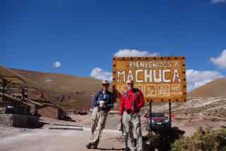
We cross an unusual landscape called a bofedal, a high altitude marsh, where two streams meet in a bottom, and high golden reeds grow rampant. The herders bring their animals here. A stone shelter sits on a low hill. An empty clothesline stirs in the wind. Billy points to a slab of mountainside rising beyond the moor. Over that is Machuca. He must think we think just another hour and a half of hiking straight up is encouragement.
At dinner a few days ago, we were talking about Toco, another volcano cone, our climb for the next day. It’s 5600 meters – 18,000 feet. Everything out here seems to be 18,000 feet. Mt Whitney in the California Sierras is the highest peak in the Lower 48 at 14,505. Toco is 3500 feet higher.
The typical hazards of elevation are headache, nausea. I know from personal experience. Also, he mentions, as an afterthought, the risk of stroke, what they call ischemia or blood clots in the brain. This is mind-focusing. Ken is a doc and describes the dangers of your heart pounding in an oxygen starved frenzy. Bad things can happen.
Instead, the last hiking day, we climb Copacoya, a 16,000 foot peak overlooking Tatio, a geyser field. According to Ken, our statistician and custodian of records, this would be a personal best, far higher than the 14,200, logged in the San Juans several years ago.
Copacoya is a beautiful hike but slow. Anything much beyond a trudge is impossible in the thin air. The views of the Atacama to the west and the Altiplano to the east are panoramic. There is an interesting plant, almost the only plant, the Jarreta, a bright green, moss-like blanket almost as hard as the rock it grows on. We climb past 14,500, and finally clear 15,000. We stop for lunch at the peak, at 15,750, a record I have no interest in surpassing.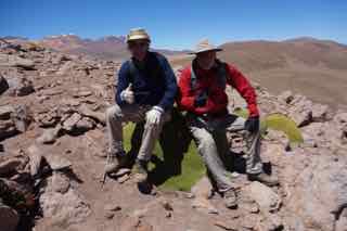
That night, our last, the elephant lurches down a miserable, stone-strewn track into a canyon. How the tires, loaded to the axles, survive seems like a gamble to me. Next to a cluster of steaming geothermal pools we stop.
We camp at 14,200. It is late afternoon but already cold at this altitude. It will become bitter cold with nightfall. I have been acclimatizing for a week but it’s for naught. The night is hard, the first in decades without the first wink of sleep. Each time my eyes close, my breath stops. In moments I am jolted awake, suffocating. I pull out a book and count the minutes till dawn.
At dinner, while I glumly consider the options of medical evacuation, Ken is full of cheer, smoking cigarettes and sloshing down wine. He is animated, explaining to our baffled companions his accountant daughter’s compliance challenges with American insider trading rules. They have no idea, of course, what he is talking about. I think it is contributing to my nausea. But he and they seem to be enjoying themselves.
After a sleepless night the chilly dawn feels surprisingly good. Why not, there’s no place to go but down. In the semi-dark I help Billy strike the kitchen tent. The water jug is frozen. The cold is biting but clean and astringent. As we descend into the desert my brain cells soak up the oxygen. I feel almost giddy. Billy takes one more detour, plunging off the Calama highway into the scrub. He drives and drives down a winding track, crashing through the desert shrubs.
Under a bright sun, in the middle of a sandy flat, he stops the truck and pulls a table from the equipment pile. He spreads a cloth, makes coffee, and puts out some breakfast. We enjoy one more moment surrounded by the Atacama. We sip coffee in the midst of this splendid piece of nowhere, a tabletop plunked in the middle of the desert. Ken lights a cigarette.
Iceland Trek
Posted on January 29, 2018 - Leave a Comment
My Trek in Iceland
The sleet made progress slow. Ahead a white light flickered atop a pole sticking from a pile of rocks. It was a beacon of some sort. Hope flutters in my breast. Maybe it’s the top. Maybe we can trudge through the wind, sleet and snow, but at least do it downhill for a while.
We’ve been climbing all day in full packs, the last few hours through a wilderness of snowfields. At the crest of each slope, we peer into the sleet, looking for the hut where we’ll spend the night. But … nothing. The trail dips and begins another climb. It’s been doing this all afternoon. At the rock pile Jim holds his hiking stick in the air. The wind is blowing. I joined him. He pointed through the sleet. There it was, the hut, our hut, a hundred yards away. Hrafntinnusker, it’s called. Don’t even try to pronounce it. Clear your throat twice while rolling your tongue. Our relief is hard to describe.
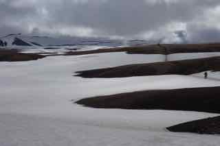
Snowfields below Hraffntinuskerr
The plane touched down in Reykjavik at 6:30 in the morning. Groggy with missed sleep and four hours out of our time zone, we head to the Blue Lagoon. It’s a famous spa, a lake of hot water, heated in the deep fissures of an extinct volcano. The volcano no longer erupts, but heats enough hot water to warm most of Reykjavik. They pipe the hot water through their houses and even under parking lots to melt the snow. Its how they heat the bunkhouse at Hrafntinnusker. There are no fireplaces or propane heaters. Thin metal pipes run from floor to ceiling. It’s a comfortable heat.
It’s a good way to wake up, wading in the mist of Blue Lagoon. A water-side kiosk offers a tub of silica mud – to give the skin that ingenue look. Here we are two hours off the plane, wandering half-awake in a fog of steaming water surrounded by half-naked people painted like Amazonian cannibals. Welcome to Iceland.
We drove on to Reykjavik and found our lodging for the night – although here, close to the Arctic Circle, night is a relative term. It never gets dark. Nine days and not a moment of darkness. It puts you a little off balance. At a quarter to midnight it could be late afternoon.
I wandered through the city. It’s not big, two hundred thousand people maybe. It rises from the harbor up a broad hill. At the top is Hallgrimmkirja, a new and starkly modern church. Its gray pyramidal tower has become the signature of the Reykjavik skyline.
Jim and I dispute whether its a church or a cathedral. We debate this kind of stuff. Its Lutheran, he insists. They don’t do cathedrals. Architecturally, it’s a basilica, like the Vatican, I point out – prideful of the first and very last fact I possess about religious architecture. If it quacks like a duck.
He and I have had this sort of relationship since school, oh, so many years ago. I enjoy the back and forth with Jim. He does not. It irritates him. It is one of my defining traits: the talent for irritating even my friends. But we’ve been doing this for so long, we forgive and forget. For almost forty years he and I, Ken, Phil and Randall have been hiking together. Its a great friendship. I have come to appreciate it more. We can call it a church.
The city is Nordic, which means it’s clean and things runs on time. The transport people said a van would be at our hotel at seven. It was there at the strike of the hour. It’s modern, cosmopolitan, with great restaurants and even a sense of humor. A billboard for one of the older outfitting companies carries the caption “Waiting for summer since 1927”.
The city is also growing, with cranes everywhere stabbing the skyline. But the language is old, a legacy of the early Norwegians who settled the place. Many of the words are unpronounceable. Full of growls and clicks.
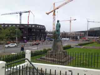
Downtown Reykjavik
The people are polite and considerate. I waited in line in a crowded bakery, in a hurry one morning, and failed to take a number. At the counter, I was embarrassed. The fellow behind me silently handed me his number, stepped back and took another. When I thanked him, he bowed without saying a word.
Iceland is expensive. Presumably much is imported. The prices, once you’ve done the mental currency conversion, are shocking. A basic burger runs something like $25. If I didn’t know my friends better I’d worry it might discourage their alcohol consumption.
The Laugavegur is an internationally popular trekking trail. It’s close to 40 miles long, and runs through some of the world’s most spectacular scenery. The country is an island in the North Atlantic, southeast of Greenland. It is slowly but inexorably being ripped in two by the tectonic forces prying open the Atlantic Ocean.
The volcanic seam that traces the middle of the ocean runs right through Iceland. You can step on the fault blocks where the North American plate and the European plate are pulling in opposite directions.
It’s a land of lava and volcanoes, many of them extinct, a number of them distinctly not. Eyjafjallajokull (unpronounceable unless you can reverse click) erupted in 2010, throwing up enough ash to shut down European air traffic.
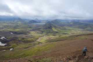
The green livery of Iceland
From the high points on the trail the distant landscape has a fairy-tale quality. It is no surprise I suppose that they are big on elves and trolls. There are few trees. Everything is draped in a livery of yellow-green moss. It is a heavy frosting dripped across the lava fields, a velour carpet on the farther hillsides, and a veneer of paint on the distant peaks. The landforms are a jumble of old volcano cones, table-top mountains – the curious offspring of sub-glacial volcanic eruptions – and basins sinking as the earth divides.
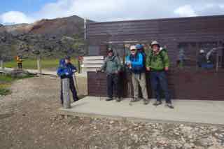
Hitting the trail and Landmannalauger
The trek begins in Landmannalaugar, a half-day’s drive into the interior. It’s a bustling camp. A few small buildings, a field full of tents, and two converted busses, offering sandwiches and potato chips to the trekkers. There is a crowd of day-trippers, heading into the sunny hills.
We are climbing out of a caldera – the collapsed remains of an old volcano. We are entering what they call in Iceland a “high heat area”. The trail threads among steaming, sometimes boiling, pools, fumaroles of stinky gas, and in many places boulders by the side of the trail venting clouds of hydrogen-sulfide – the smell of rotten eggs. It is the smell of magma, the molten rock simmering somewhere below. Here, in Landmannalauger, it is not that far below.
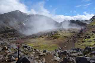
Rocks venting hydrogen sulfide gas
As we climb, the day-crowd disappears. We have full packs, which was not my idea. So the going is a little breathless on the steep sections. By midafternoon we emerge at what feels like the top of the world, a weird landscape of snowfields and dark lava hills. The trail runs from snowpack to lava, back and forth. There is no break from the wind. It is relentless and pelts us with sleet. But the sleet comes and goes, turns to drizzle, peters out, returns and is gone again. This is Icelandic weather. They can be a little snippy about it. What’s the weather, you ask. Look outside, the reply, it’s Iceland.
The climb is more than we expected. I don’t remember anything in the guidebooks about a torturous, unforgiving ascent through wind and sleet. One fellow did mention his exuberance at arriving at Hrafntinnusker. Now I understand. We have made reservations to stay in the bunkhouses – called huts – at Hrafntinnusker, Aftavatn, Ermstrur and Thorsmork. They are sanctuaries from the weather.
The huts are crowded with people mostly from Europe. One couple, a German fellow and his Spanish wife, spoke Spanish. A larger group was French. Another from Spain. But everyone it seems, except the French of course, speaks a little English, particularly the Icelanders, almost all of whom speak it well. For myself, I know enough French to elicit contempt from the French, enough Spanish to elicit pity, and enough Icelandic to prompt uncomprehending stares.
Our corner of the hut, which houses twelve bunks, is our group and the French. No struggling through the snow with packs for these people. They had food shipped in ahead of time and are busy cutting up vegetables and meat for a large pot of soup simmering on a propane stove in a communal kitchen. It appears that what they say of the French, that they live better than we do, is true. They certainly eat better. We paw through our packs for freeze-dried dinners, sip a little bourbon, and try not to envy the French.
The first day was tough and tiring. Aftavatn, the next camp, is not so bad. We spent an hour or so traversing the snowfields, up steep hillsides and down, but eventually began to descend. The sun came out. There’s a river to cross. This is a drill we’ve prepared for. Pull off boots, pull on river shoes. The water was painfully cold. My feet sort of liked it – for a minute or two. And that’s all it takes and we’re across.
The rivers swirl and churn with summer’s glacial melt. Iceland, predictably, has a lot of glaciers and snowpack. At a crest on the trail we spy the looming edge of one of Iceland’s larger glaciers, Myrdalsjokull. It is a sprawling, gleaming snowfield of immeasurable size. It creates a sense of infinity, where the whiteness rises to the sky and dissolves in the distant horizon.
Aftavatn sits by a lake and in fact the name refers to a lake. Descending from the highlands, we can see it blue and serene in the distance. But it’s not serene once we arrive. The wind is ferocious. We watch a couple of campers staking out a tent whose flaps are blowing horizontal.
Our small bunkhouse shares a kitchen with a group of Americans from NOLS – national outdoor leadership something or other. It is a group of Western people who live for the outdoors.
One woman did her qualification test, dropped somewhere in the tundra of northern Sweden. It is an unusual calling to devote your life or at least your free time – they all seem to have day jobs – to mastering life in the wild outdoors. They insist they are not survivalists – it is more than that. Although I don’t think I quite got the hang of it, it sounds like a type of guide training. One fellow was leaving in a few weeks to take a group of devotees sea-kayaking in Croatia.
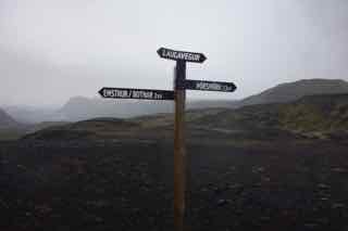
Trail markers
There are hot showers at Aftavatn. Five bucks for five minutes, or five hundred kronur. The currency sort of works out to moving decimal places. A thousand kronur is something under ten bucks. You can make mistakes. I gathered up a handful of skin care stuff at Blue Lagoon, thinking I was spending 35 dollars, only to find out I had just spent $350. I begged to reverse the transaction. They were very nice. I’m not the only dumb one apparently.
In a cruel trick, the ticket desk for the showers is at one end of the camp; the showers themselves at the other. The blustery wind is cold enough just getting from the bunkhouse to the ticket building. The sprint to the showers completes the freezing process, where we wait in line shivering on a windswept porch, counting the people ahead and multiplying the minutes. Five minutes is barely enough time to thaw.
Aftavatn is a part of the island rift zone. As the plates move apart (what was once poetically called “continental drift“ is now called plate tectonics) forces in the Earth’s mantle fracture the surface causing places like Aftavatn to sink.
The geology is complicated by the volcanism, much of which takes place beneath thick glacial icesheets. Strangely, there are volcanoes which don’t see the light of day, where the heat of molten rock, for a while at least, is matched by the bulk of the ice. The rock created at the meeting of volcanic magma and glacial ice has the technical name of hyaloclastite and is one of Iceland’s unique minerals. Here the icy cold lives cheek to cheek with the super-hot.
If you have curiosity about the way the planet hangs together, there is no place like Iceland. In Thingvellir, the site of the first Icelandic Parliament more than a thousand years ago, a footpath descends between rock walls, which year by year, inch by inch, are pulling away from each other. We are walking, in a sense, between two continents. Where the land is pulling apart, magma – molten rock from the mantle – rises to the surface as lava.
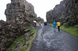
Between the fault blocks at Thingvellir
Underground, Iceland is in a state of flux and violence. There are hundreds of earthquakes each year, most too small to notice. The more or less constant jostling of the tectonic plates are continually reworking the faults and fissures, recharging the geysers, replumbing the channels for the deep geothermal water.
Lava defines much of the landscape. There are long stretches of highway running between moss-draped plains of lava rock. The airport is built on a lava plain. Roads are built along ancient lava flows. Many mountains are simply accumulated lava flows left standing after the ravages of Ice Age glaciers.
The hike out of Aftavatn heads straight up Bratthals, the hyaloclastite mountain flanking the lake. It is a sullen uphill slog. After Bratthals, we headed down. Today is a ten-miler. We enter a sunny and picturesque valley. The sun is warm. We take a break at an old shepherd’s shelter. Next to us is the Storasula, the cone of an extinct volcano. Soon we cross the Blafjallakvisl, and then over a sturdy a footbridge over the raging Kaldaklofskvisl.
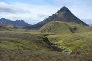
Storasula, an ancient volcanic cone.
We are soon heading into a desert – a broad plain of black dirt. Here again is Myrdalsjokull. We see only a glimpse between two mountains but it is otherwordly, a trackless expanse of ice and snow. Beneath the glacier is an active volcano, Katla, which last erupted in 1918.
Emstrur, the next camp, comes into view far below as a cluster of red roofs. The sun is out as we approach, but the sky grows gray and begins spitting rain as we arrive. There is something going on. A vibe of concern. People are talking about the weather. The warden confirms it. “Crazy weather” coming in, she says, waving her hands. It may make the bridge to Thorsmork impassable.
People are beginning to leave. Are they going to Thorsmork? It’s ten miles away. This is hard to make sense of. Its 6:00 in the afternoon. Okay, so it doesn’t get dark, but it still seems a little hysterical. I’ve just hiked ten miles with a backpack. It would just about take an asteroid strike for me to put that pack back on.
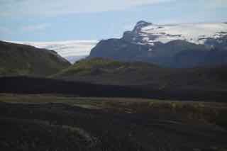
A glimpse of Myrdalsjokull Glacier
My friends and I dismiss the weather scare. We’re Americans, optimistic, practical and just a little lazy. The report is already changing. The front won’t arrive until tomorrow afternoon. The warden concedes that communication isn’t so good here, so the weather report can be taken with some skepticism. We’ll just get up early.
The weather crisis is actually working in our favor. There are fewer people and the hut is no longer crowded. The upper bunks where Randall and Ken and I have scattered out things are almost empty. The bunks are little more than a platform up in the gable with mats laid side by side. There’s plenty of room. It’s also a little darker up here in the windowless garret. Less of the midnight sun. I’ll sleep better.
We’re out by 7:30 and headed to Thorsmork. We cross a gorge. It’s called the Markarfljotgljufur.
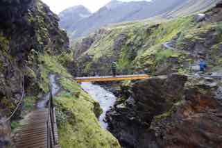
Markarfljotgljufur, a river or a canyon
I’m not kidding. The stream is wild, pouring through the canyon walls beneath us. To stand on a narrow foot bridge a few feet over a seething river gives you a different perspective. I’m not sure of what, but a sense of the good things in life one might miss.
We drop out of the canyon country into another desert, this one larger than yesterday’s. An endless expanse of monotonous black dirt stretching to distant mountains etched dimly on the horizon. Its hard to photograph. There’s nothing to take a picture of. Which, of course, is the special beauty of it. It’s a nothing like you’ve never seen before, a stark windy plain stretching to low spiky ridges. It could be another planet.
On the first day we saw no vegetation at the high elevations. Too cold and windy. Here, it’s different. The ground is littered with volcanic debris. I pick up a couple of lava pieces to take home. Its not even cold, but there’s barely a tuft of grass.
Ken has reserved a Volcano Hut in Thorsmork. In the trail guide we are given to understand that we are buying into some level of luxury. In fact it’s a simple bunkhouse. It’s small and crowded. But at least it’s just us. No French folk making us feel like American society has lost its way in anomie and commercialism. The weather prediction is about right. Not long after we get in, the rain begins. But there are hot showers and no time limits.
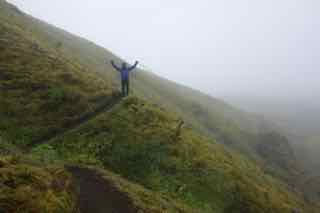
Randall outside Thorsmork
We’re a second day in Thorsmork. It’s rainy, not raining, but rainy in the Icelandic mode of drizzle that turns off and on. Ken, Jim and Phil won’t budge. Randall and I pull on rain gear and head out. I’m delighted just to hike with a daypack. We pick a two hour hike, miss a turn, end up at another hut by a river. We get our bearings and head back out. We stop at Skaggi, a cave memorable for my stumble into a man-size hole in front of Skaggi. I’m hypnotized by the cave and walk right into it. Its full of bushes and roots, more a gentle tumble than a full-scale plunge.
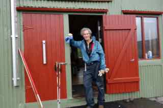
Not sure where we are outside Thorsmork
We climb a trail that heads uphill and away from the settlement. Randall, who is the corporate suit in the group, a highly paid tool of some multi-tentacled hydra in New York, is actually the most adventurous. He and I climb a knife-edge of rock overlooking the river. The current has undercut a promontory which juts over the water. We find another path leading who knows where and just follow it. It takes us up and through a welter of low birch groves into a clearing at another promontory. A large pile of rocks announces that this is the end of the trail. Below us and away we see a corner of the Thorsmork camp. We share a bar of something. I adjust my jacket to accommodate the assortment of lava rocks I am compelled to collect.
At dinner Ken announces his retirement. He is a psychiatrist and his group has just sold their building. He’s grown weary of the profession, not so much the hopeless parade of misery he sees each day, but the accelerating bureaucracy of medicine. We toast him with shooters of Bjork, a good Icelandic drink. Skal, as the Icelanders say. Cheers.
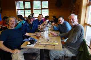
Final night at Thorsmork
Gulf Shores Postcard
Posted on June 17, 2011 - Leave a Comment
During Spring Break we went to the beach. Our beach is in Gulf Shores, Alabama. We have a ground floor condo unit, with a pleasant stretch of lawn in front, beyond which is nothing but blue ocean. We like the sand, the seafood, the sunsets. Wheeler, our twelve-year old, brought his friend Cameron. I think they had a good time. They were, the very first day, talking to some older 8th grade girls in the hottub, my wife reported. “How are the girls”? I asked when they got back. “They were totally digging us,” he grinned. Totally digging us. This is not the answer I’m looking for. I am not sure why.
There was a church group from Indiana. Wheeler and Cameron were in luck. Right out our front door the Hoosiers put together a dodge ball tournament. Somebody yelled “dodge ball” and in moments, it seemed, the place was screaming with kids. It was pretty organized: a mesh bag full of colored balls, and an assortment of plastic cones to mark the field.
A loud, beefy, forty-something guy, Dave, was apparently the commissioner and was running the show. Shirtless and clutching a Corona, he refereed the games, bellowing like a drill sergeant. “You, you, yeah YOU, you’re out, out, get out, you’re out”. And a kid would slink over to the sidelines. I’m with Sergeant Dave on this. It is a contest, it turns out, that requires something like military supervision. I can’t recall ever seeing a game so full of, well, cheating. It is almost part of the happy chaos of the game.
The way dodgeball works, of course, in theory, is you sit down if someone hits you with a ball. But in practice you sit down only if several people saw you get hit and won’t stop howling until you do. With so many kids darting in so many directions it is hard to keep up with which ball hit which kid, so very few, at least in the early going, when there are lots of kids, ever sit down, knowing the chances are pretty good that nobodybut the guy who hit you saw you get hit. He can yell all he wants, but if nobody saw it, how long is he going to stand there protesting before he himself takes one off the forehead, in front of Big Dave no less, and gets yanked off the field, miffed and indignant, while the culprit on the other side throws him a quick smirking grin.
Even when a kid, caught in flagrante delicto, actually leaves the field, more often than not he re-appears mysteriously a minute later, playing as though nothing happened. This is tough on the adults, who have lost most short-term memory and really can’t recall if the kid got hit this game, last game or yesterday. As bad money drives out good, the cheating largely takes over, and gives the whole matter just a tinge of a street fight.
And the rules. My childhood memory of dodge ball was a whole lot different. It was gym-class on a drizzly day. You took a ball, an old volley-ball typically, scuffed and dirty, and winged it as hard as you had at the guys across the gym. Not exactly chess. In 21st Century dodge ball, there are exactly so many lollipop-colored balls stretching across the centerline, maybe ten or more. I say “exactly” because if Detective Dave doesn’t count the right number, game is suspended for an easter egg hunt through thebushes. Variations include setting the balls in patterns to make the scrum more interesting.
The opening moments are dramatic. His eyes narrowed, Dave scans the array on both sides, telling this kid to move back a few inches, this kid over a little bit. He rubs his jaw, studying the teams, and finally drags one kid over to the other side, and drags another the other way. He must be more bark than bite, however, because more than once he ordered a kid to move back behind the line, only to have the enterprising young fellow simply reach behind him, pick up the cone and put it down in front. As I said, devotion to the principles of fair play is not on parade here in dodgeball.
When there is, finally, a perfect symmetry to both teams, Dave barks, in a bootcamp voice, “DODGE-ball”. The kids then rush to the balls and commence to bonking the beans out of each other, balls ricocheting all over the place. If you hit someone, they’re out, unless they catch it, then you’re out, but if they’re holding a ball and your ball hits their ball, nobody’s out, unless someone else on their team catches your ball on the rebound, then you’re out, or you catch your own ball on the rebound from their ball, then they’re out – I think. The game moves fast, the cheating faster, so sometimes its hard to divine just which rule it is that has this kid jumping up and down in protest.
There are also infractions, policed by you-know-who. He harbors a special contempt for the “line-huggers” – those kids who stick close to the back line, either as a tactic or in huddled terror of those flying balls. It is no less than cowardice under fire to Field Marshal Dave, who struts Patton-esque along the sideline, hurling insults and threatening consequences to those who won’t come out and fight. It is a metaphor for life, with Dave, a prism through which to glimpse the depths of the soul, the elation of victory, the bitter taste of defeat, not to mention the subtle human satisfaction of riding to victory on the wings of guile and deceit. I’m not sure I get it, but then I don’t have to. I’m on vacation.
Hip-Hop Summit
Posted on May 9, 2011 - Leave a Comment
April 20, 2008.
With a wife and kids and work to do, I miss most of the seminal cultural events of our times. One is happening this weekend. In Philadelphia, Temple University is hosting the Turn Up the Vote National Hip Hop Summit. It’s sponsored by something called the Hip-Hop Summit Action Network (in cooperation with various departments of probation and parole).
Technical problems plagued Friday’s opening ceremony, when the metal detectors short-circuited. When power was restored, the sponsors made a quick rule change. Only fully automatic firearms would be checked at the door. Knives, needles and crackpipes were permitted.
At the top of the list of speakers is Clifford Harris, Jr., an Atlanta rapper known as “T. I.” T. I. boasts an impressive curriculum vitae, recently polished with pleas to three firearms violations. Barred from voting as a convicted felon, T. I. is reaching out to wannabe rappers to share what it means to lose this precious right.
�
Reporters caught up with T. I. at a strip club in the city’s Combat Zone. “I’m here to share the importance of getting out the vote”, he stated – as he slipped a few bills into the thong of a lapdancer. According to Harris, the rap community wants to devote a full third of their probationary community service hours to making violent young sociopaths aware that they too have a voice. “This is my way of giving back”, he remarked, as he and the lapdancer tossed back a couple of shooters.
�
Asked about his previous voting experience, T. I. laughed. “Well, I ain’t never been in no voting booth, but that don’t mean I don’t get my vote”, as he patted a sinister bulge under his jacket. “And when I vote, dis m___ f___ be da majority.”
When discussing his preferences among the candidates, T. I. immediately became serious and passionate. “Kanye thinks he be the top dog”, he spluttered. “The Snoop Dogg, he got ripped off. Them Grammys ain’t worth nothin’. You wait, though, T. I.’s on a comeback. I’m goin’ platinum with my new download, ‘Talkin’ wit’ my Glock’. Now that be a lean mean votin’ machine.”
As the rapper settled in for another lap dance, a reporter called out, “the name ‘T. I.’, where’d that come from?” “Beats me” the rapper responded. “If your mama named you ‘Clifford’, would you be asking questions?”
Postcard from Boston Garden
Posted on May 4, 2011 - Leave a Comment
POSTCARD FROM THE GARDEN
It’s good to go home from time to time. Especially in the winter. There’s nothing like a few days of February in Massachusetts to remind you why you left. It’s 13 degrees. I was going to say ‘above zero’, but at that temperature what difference does it really make. When I went jogging yesterday a frigid gust swept up the street, slowing me almost to a stop. Through layers of clothing it chilled me right to the skin. �
It’s been snowing forever this season. There’s two feet on the ground, plowed into peaks and ridges on street corners and in parking lots. Snow is like a rock star. Great when its young – but it doesn’t age well. It’s only been a couple of weeks, but it already has a Keith Richards kind of look to it. It’s mottled, speckled, past its prime. When the sun is out, the glare is blinding. Winter is a challenge here.�
Wheeler and I arrived Wednesday night. We had tickets to see the Celtics in the Boston Garden – though that’s not what they call it anymore. In what has become a commonplace act of prostration before the whore goddess of ‘branding’ the place is now called TDGarden. I don’t know what a TD is. I’m hoping it’s not a boner pill. But I was raised here so for me it’s Boston Garden, or just the ‘Garden’. Yet I got a head’s up on that too. I pulled up to the toll-booth in the Sumner Tunnel. “Afternoon” I said. “Hiyowahya”, the guy responded, in his native tongue. “Am I heading toward the Garden?” He looked at me. “You mean, the GAH-den?” I stand corrected. It is, in fact, and always will be, the Gahden.
Alas, in truth, Boston Garden is gone. The Celts played there from 1928 until 1995, when it closed and they moved next door to the Fleet Center. Had to happen I suppose. The old building didn’t even have air-conditioning. Although the four walls are new, the spirit lives in the avatar of the Floor. The new Garden, even with all the hi-tech screens and graphics, has the feel of a shrine when you walk through the portal and gaze down on Red Auerbach’s old parquet floor, built from scraps in the 40s, and transplanted here from the old building. The Leprechaun still grins at mid-court as he has for decades. In the rafters overhead are the championship flags – ten alone from ’59 to ’69. And the jerseys. Auerbach, Cousey, Havlicek, Larry Bird.
In Boston sports is more than entertainment. Boston is an ethnic city. They live in neighborhoods that are Irish, Italian, black. The Red Sox, Celtics, and the Bruins hockey team are part of the tribal identity. They’re crazy about these teams. We saw the Celts play – and beat – the New Jersey Nets. When the Celts re-took the lead in the 4th Quarter the crowd was riotous. And this is Wednesday night – playing the Nets. �
I’ve been gone from Massachusetts for decades but I’m still a fan. I actually have a brother who doesn’t like the Celts. Of all the loathsome apostasies, he roots for the Lakers. I hold it against him – in a small way. I can’t understand it. An ancient team, an historic pageant of accomplishment – and he prefers the Lakers? And while we’re on it, what is a Laker, anyway? There aren’t any lakes in LA that I’ve ever heard of, and if there was one, you wouldn’t let a dog swim in it.
The occasion for the trip is my father’s birthday. He’s 82. He’s doing pretty well. Although you have to watch him carefully to detect that he’s doing anything at all. He watches a lot of TV, takes walks and rides around town. But the house looks good (except for the snow), and he’s healthy. I think he’s reached a plateau where boredom is accepted as the blessing of few problems.
Like a lot of old people, he tells the same stories over and over. Yet he seems to enjoy the latest telling as much as the first. It is hard to say whether he really doesn’t know he’s telling me for the tenth time that his divorcee neighbor is sleeping with a Brazilian or that the father of a childhood friend of mine, who used to live a few houses down, was all those years a raving manic-depressive – or whether he in fact enjoys some secret dispensation of old age that disdains the conversational etiquette of the young.�
Whenever you spend a few days with my father, you become a captive of sorts. This season he is inexplicably enthused about old musicals. For much of the time that we congregated in his den, he had on some DVD narrating the fabled era of MGM musicals. I watched Gene Kelly perform Singing in the Rain probably five times. He can become pedantic about it. He stops me in mid-conversation to ask who was Gene Kelly’s favorite dance partner? No, he prompts me, it wasn’t Cyd Charisse. Alright, I give up. Its Fred Astaire, he informs me. I don’t know where this is coming from. I didn’t think he even liked movies. We couldn’t get him in the car to see the King’s Speech. Yet here he is holding a seminar on Gene Kelly. I guess it could be worse. We could be watching My Cousin Vinny.
The culmination of the weekend was dinner at an old restaurant the family used to frequent when we were young. It’s an hour away. He’s letting me drive. This is new. He has an immaculate Lexus that he washes, oh, about every single day. He has a season ticket to the car wash, and no matter what he paid, it was a bad deal for the car wash.�
But tonight he’s OK with my driving. I think this is a good sign. He’s letting go a little, learning to play better with others. I too am learning to be a little nicer. In years past when he was a passenger, I would drive up quickly on the cars in front, just to watch his right foot thumping the floor board. I’ve quit doing that – mostly.�
There is a big family gathering at the restaurant, nieces, nephews, and a proliferation of new spouses and girlfriends. I have no recollection of this place at all. It makes me uneasy that my youngest brother speaks so fondly of it. How much of my childhood have I simply repressed? The conversation is lively. The menage of aunts and uncles growing ancient, brothers growing a touch gray, a newly married niece, my brother’s four little children – the intersection of these souls around a long table makes for a pleasant evening. The mid-winter night, just outside the window, is howling cold. The food, a buffet of some sort, looks like it’s been sitting under a heat-lamp for a week, yet life really couldn’t be better. And the last I checked, the Celts are still on top.
